Area Overview for HU5 4BL
Photos of HU5 4BL
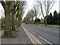


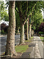
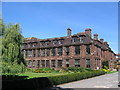
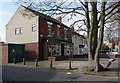

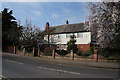


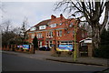
100 photos from this area
Area Information
Key information about the HU5 4BL including its size, population, and administrative classification.
- Area Type
- Postcode
- Area Size
- 1.3 hectares
- Population
- 1404
- Population Density
- 2602 people/km²
House Prices in HU5 4BL
16
Properties
£231,625
Average Sold Price
£128,500
Lowest Price
£342,000
Highest Price
Showing 16 properties
| Address | Type | Beds | Baths | Last Sale Price | Last Sale Date | |
|---|---|---|---|---|---|---|
| 446 Chanterlands Avenue, Kingston Upon Hull, HU5 4BL | Detached | 4 | 2 | £342,000 | Nov 2023 | |
| 436 Chanterlands Avenue, Kingston Upon Hull, HU5 4BL | house | 3 | 2 | £289,000 | Nov 2023 | |
| 434 Chanterlands Avenue, Kingston Upon Hull, HU5 4BL | Detached | 3 | 2 | £290,000 | Dec 2022 | |
| 460 Chanterlands Avenue, Kingston Upon Hull, HU5 4BL | Detached | 3 | 1 | £286,000 | Jul 2021 | |
| 432 Chanterlands Avenue, Kingston Upon Hull, HU5 4BL | Detached | 3 | 2 | £267,500 | Jul 2019 | |
| 438 Chanterlands Avenue, Kingston Upon Hull, HU5 4BL | Detached | 2 | 1 | £136,780 | Dec 2012 | |
| 456 Chanterlands Avenue, Kingston Upon Hull, HU5 4BL | house | - | - | £210,000 | Dec 2012 | |
| 444 Chanterlands Avenue, Kingston Upon Hull, HU5 4BL | Detached | 4 | 1 | £231,500 | Dec 2012 | |
| 448 Chanterlands Avenue, Kingston Upon Hull, HU5 4BL | house | 4 | - | £205,000 | May 2010 | |
| 464 Chanterlands Avenue, Kingston Upon Hull, HU5 4BL | Detached | 4 | 2 | £128,500 | Apr 2006 |
Page 1 of 2
Energy Efficiency in HU5 4BL
Amenities
Schools
| Rank | School | Type | Entry gender | Ages |
|---|
Explore more schools in this area
Go to Schools tabDemographics
Household Size
Two person
most common
Accommodation Type
Houses
most common
Tenure
71
majority
Ethnic Group
White
most common
Religion
N/A
most common
Household Composition
N/A
most common
Age
47
median
Adults (30-64 years)
most common
Household Deprivation
N/A
with no deprivation
NS-SEC
36
in Lower managerial occupations
Explore more demographic insights in this area
Go to Demographics tabPlanning
Planning Constraints
- Flood RiskPremium
- Ramsar Wetland SitesPremium
- Area of Outstanding Natural BeautyPremium
- Protected Nature ReservePremium
- Protected WoodlandPremium