Area Overview for HU5 3UB
Photos of HU5 3UB
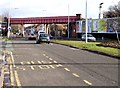
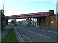
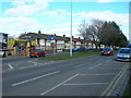
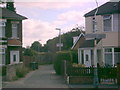

100 photos from this area
Area Information
Key information about the HU5 3UB including its size, population, and administrative classification.
- Area Type
- Postcode
- Area Size
- 1.9 hectares
- Population
- 1633
- Population Density
- 4102 people/km²
House Prices in HU5 3UB
37
Properties
£62,171
Average Sold Price
£20,000
Lowest Price
£144,000
Highest Price
Showing 37 properties
| Address | Type | Beds | Baths | Last Sale Price | Last Sale Date | |
|---|---|---|---|---|---|---|
| 214 Perth Street West, Kingston Upon Hull, HU5 3UB | Terraced | 3 | 1 | £144,000 | Oct 2024 | |
| 182 Perth Street West, Kingston Upon Hull, HU5 3UB | house | 2 | 1 | £76,000 | Jul 2024 | |
| 246 Perth Street West, Kingston Upon Hull, HU5 3UB | Semi-detached | 3 | 1 | £90,000 | Jun 2023 | |
| 202 Perth Street West, Kingston Upon Hull, HU5 3UB | Terraced | 2 | - | £77,000 | Mar 2022 | |
| 186 Perth Street West, Kingston Upon Hull, HU5 3UB | Terraced | 2 | 1 | £70,000 | Jul 2020 | |
| 184 Perth Street West, Kingston Upon Hull, HU5 3UB | Terraced | 2 | 1 | £55,000 | Aug 2018 | |
| 226 Perth Street West, Kingston Upon Hull, HU5 3UB | Terraced | 3 | - | £85,000 | Apr 2017 | |
| 244 Perth Street West, Kingston Upon Hull, HU5 3UB | house | - | - | £116,500 | Apr 2017 | |
| 188 Perth Street West, Kingston Upon Hull, HU5 3UB | Terraced | 2 | 1 | £50,000 | Dec 2015 | |
| 194 Perth Street West, Kingston Upon Hull, HU5 3UB | Detached | 2 | 1 | £51,000 | Aug 2015 |
Page 1 of 4
Energy Efficiency in HU5 3UB
Amenities
Schools
| Rank | School | Type | Entry gender | Ages |
|---|
Explore more schools in this area
Go to Schools tabDemographics
Household Size
One person
most common
Accommodation Type
Houses
most common
Tenure
52
majority
Ethnic Group
White
most common
Religion
N/A
most common
Household Composition
N/A
most common
Age
47
median
Adults (30-64 years)
most common
Household Deprivation
N/A
with no deprivation
NS-SEC
26
in Lower managerial occupations
Explore more demographic insights in this area
Go to Demographics tabPlanning
Planning Constraints
- Flood RiskPremium
- Ramsar Wetland SitesPremium
- Area of Outstanding Natural BeautyPremium
- Protected Nature ReservePremium
- Protected WoodlandPremium