Area Overview for HU5 3TR
Photos of HU5 3TR
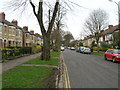
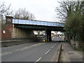
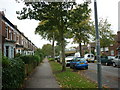

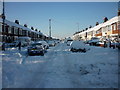


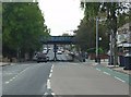

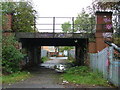
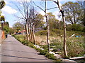
100 photos from this area
Area Information
Key information about the HU5 3TR including its size, population, and administrative classification.
- Area Type
- Postcode
- Area Size
- 7022 m²
- Population
- 1456
- Population Density
- 7320 people/km²
House Prices in HU5 3TR
26
Properties
£105,288
Average Sold Price
£36,000
Lowest Price
£165,000
Highest Price
Showing 26 properties
| Address | Type | Beds | Baths | Last Sale Price | Last Sale Date | |
|---|---|---|---|---|---|---|
| 140 Chanterlands Avenue, Kingston Upon Hull, HU5 3TR | Terraced | 3 | 2 | £165,000 | Dec 2024 | |
| 138 Chanterlands Avenue, Kingston Upon Hull, HU5 3TR | Terraced | 3 | 1 | £125,000 | Mar 2024 | |
| Flat, 152 Chanterlands Avenue, Kingston Upon Hull, HU5 3TR | Terraced | 2 | - | £92,500 | Nov 2022 | |
| 150 Chanterlands Avenue, Kingston Upon Hull, HU5 3TR | Flat | 1 | 1 | £160,000 | Aug 2022 | |
| 174 Chanterlands Avenue, Kingston Upon Hull, HU5 3TR | Terraced | 3 | 1 | £134,500 | Feb 2022 | |
| 136 Chanterlands Avenue, Kingston Upon Hull, HU5 3TR | house | - | - | £98,000 | Jul 2021 | |
| 154 Chanterlands Avenue, Kingston Upon Hull, HU5 3TR | house | - | - | £155,000 | Mar 2021 | |
| 162 Chanterlands Avenue, Kingston Upon Hull, HU5 3TR | Terraced | 2 | 1 | £83,500 | Jun 2019 | |
| 144 Chanterlands Avenue, Kingston Upon Hull, HU5 3TR | Terraced | 3 | 1 | £112,000 | Feb 2016 | |
| 172 Chanterlands Avenue, Kingston Upon Hull, HU5 3TR | Terraced | 3 | 1 | £96,000 | Jun 2014 |
Page 1 of 3
Energy Efficiency in HU5 3TR
Amenities
Schools
| Rank | School | Type | Entry gender | Ages |
|---|
Explore more schools in this area
Go to Schools tabDemographics
Household Size
One person
most common
Accommodation Type
Houses
most common
Tenure
67
majority
Ethnic Group
White
most common
Religion
N/A
most common
Household Composition
N/A
most common
Age
47
median
Adults (30-64 years)
most common
Household Deprivation
N/A
with no deprivation
NS-SEC
34
in Lower managerial occupations
Explore more demographic insights in this area
Go to Demographics tabPlanning
Planning Constraints
- Flood RiskPremium
- Ramsar Wetland SitesPremium
- Area of Outstanding Natural BeautyPremium
- Protected Nature ReservePremium
- Protected WoodlandPremium