Area Overview for HU5 3SW
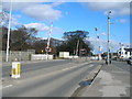
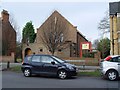
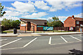
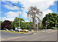
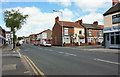
Photos of HU5 3SW


Area Information
Living in HU5 3SW offers a compact, residential experience shaped by its small cluster of homes and proximity to essential services. With a population of 1,429, the area feels close-knit, where daily life is influenced by nearby schools, transport links, and retail options. The community is primarily composed of adults aged 30–64, reflecting a mature demographic that values stability. While the area is small, it is well-connected to surrounding regions via rail and ferry services, making it practical for commuters or those seeking access to larger urban centres. The absence of major environmental constraints, such as protected woodlands or flood zones, means residents face minimal planning restrictions. For those prioritising safety, the area’s low crime risk and flood risk further enhance its appeal. HU5 3SW is not a sprawling suburb but a focused neighbourhood where homes are predominantly owner-occupied, offering a distinct character that contrasts with larger, more diverse urban areas.
- Area Type
- Postcode
- Area Size
- Not available
- Population
- 1429
- Population Density
- 11350 people/km²
The property market in HU5 3SW is characterised by a 49% home ownership rate, indicating that nearly half of properties are owner-occupied, while the remainder are likely rentals. The area’s accommodation is predominantly houses, which suggests a focus on single-family homes rather than flats or apartments. Given the small population and limited land area, the housing stock is likely to be modest in scale, with limited scope for expansion. For buyers, this means a market where properties are not in high demand but may offer value for those seeking a stable, low-maintenance home. The absence of major planning constraints, such as protected areas or flood risks, reduces uncertainty for investors or homeowners. However, the small size of the area means that the immediate surroundings are crucial for assessing property potential. Those considering HU5 3SW should evaluate nearby developments and connectivity to larger towns, as the local market is unlikely to offer significant growth.
House Prices in HU5 3SW
No properties found in this postcode.
Energy Efficiency in HU5 3SW
Residents of HU5 3SW have access to a range of amenities within practical reach, including retail outlets like Sainsburys Chanterlands, Heron Sculcoates, and Sainsburys Princes. These stores provide convenience for everyday shopping, from groceries to household items. The area’s rail network connects to Hull, Cottingham, and New Holland stations, offering easy access to urban centres and employment opportunities. The Hull Ferry Terminal adds another layer of connectivity, particularly for those needing to travel to nearby towns or ports. While the area lacks large parks or leisure facilities, the proximity to rail and ferry services suggests a lifestyle focused on mobility and access to broader regional amenities. The presence of multiple retail options and transport links contributes to a practical, functional daily life, ideal for those prioritising convenience over expansive recreational spaces.
Amenities
Schools
Residents of HU5 3SW have access to two primary schools: Thoresby Primary School, which holds an outstanding Ofsted rating, and The Language Unit, though its specific function is not detailed. The presence of an outstanding primary school is a significant advantage for families, offering high-quality education with strong performance indicators. Thoresby Primary’s rating suggests a well-run institution with effective teaching and support systems. The Language Unit, while categorised as 'other', may cater to specific educational needs, such as language acquisition or specialist programmes. The combination of a top-rated primary school and additional educational facilities indicates that the area supports family-oriented living. However, the absence of secondary schools within the immediate vicinity means families may need to consider proximity to larger towns for further education.
| Rank | School | Type | Entry gender | Ages |
|---|
Explore more schools in this area
Go to Schools tabDemographics
The population of HU5 3SW is 1,429, with a median age of 47 and a majority of residents aged 30–64. This suggests a community of established adults, likely with families or long-term ties to the area. Home ownership stands at 49%, indicating a mix of owner-occupied properties and rental homes. The primary accommodation type is houses, which aligns with the area’s residential focus. The predominant ethnic group is White, reflecting a homogenous demographic profile. While no specific data on deprivation is provided, the low crime risk score of 79 (a low risk) and absence of environmental constraints suggest a relatively stable quality of life. The age distribution implies a balance between active professionals and retirees, with fewer young families compared to other areas. This demographic structure may influence local amenities, such as schools and retail, which cater to adult needs rather than those of younger children.
Household Size
Accommodation Type
Tenure
Ethnic Group
Religion
Household Composition
Age
Household Deprivation
NS-SEC
Explore more demographic insights in this area
Go to Demographics tabPlanning
Planning Constraints
- Flood RiskPremium
- Ramsar Wetland SitesPremium
- Area of Outstanding Natural BeautyPremium
- Protected Nature ReservePremium
- Protected WoodlandPremium