Area Overview for HU5 3PL
Photos of HU5 3PL

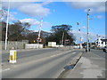

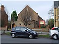


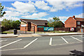
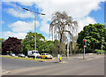
100 photos from this area
Area Information
Key information about the HU5 3PL including its size, population, and administrative classification.
- Area Type
- Postcode
- Area Size
- 5906 m²
- Population
- 1429
- Population Density
- 11350 people/km²
House Prices in HU5 3PL
50
Properties
£72,793
Average Sold Price
£12,000
Lowest Price
£116,500
Highest Price
Showing 50 properties
| Address | Type | Beds | Baths | Last Sale Price | Last Sale Date | |
|---|---|---|---|---|---|---|
| 183 Blenheim Street, Kingston Upon Hull, HU5 3PL | house | 3 | - | £80,000 | Aug 2025 | |
| 157 Blenheim Street, Kingston Upon Hull, HU5 3PL | Terraced | 2 | 1 | £78,000 | Aug 2024 | |
| 201 Blenheim Street, Kingston Upon Hull, HU5 3PL | Terraced | 2 | 1 | £101,000 | May 2024 | |
| 119 Blenheim Street, Kingston Upon Hull, HU5 3PL | Terraced | 3 | 1 | £98,000 | May 2024 | |
| 177 Blenheim Street, Kingston Upon Hull, HU5 3PL | Terraced | 2 | 1 | £85,000 | Apr 2024 | |
| 159 Blenheim Street, Kingston Upon Hull, HU5 3PL | Terraced | 2 | 1 | £102,000 | Apr 2023 | |
| 193 Blenheim Street, Kingston Upon Hull, HU5 3PL | Terraced | 3 | 1 | £110,000 | Aug 2022 | |
| 203 Blenheim Street, Kingston Upon Hull, HU5 3PL | Retail | 2 | 1 | £100,000 | Jun 2022 | |
| 209 Blenheim Street, Kingston Upon Hull, HU5 3PL | house | 2 | - | £105,000 | Jun 2022 | |
| 139 Blenheim Street, Kingston Upon Hull, HU5 3PL | Terraced | 2 | 1 | £72,500 | Nov 2021 |
Page 1 of 5
Energy Efficiency in HU5 3PL
Amenities
Schools
| Rank | School | Type | Entry gender | Ages |
|---|
Explore more schools in this area
Go to Schools tabDemographics
Household Size
One person
most common
Accommodation Type
Houses
most common
Tenure
49
majority
Ethnic Group
White
most common
Religion
N/A
most common
Household Composition
N/A
most common
Age
47
median
Adults (30-64 years)
most common
Household Deprivation
N/A
with no deprivation
NS-SEC
31
in Lower managerial occupations
Explore more demographic insights in this area
Go to Demographics tabPlanning
Planning Constraints
- Flood RiskPremium
- Ramsar Wetland SitesPremium
- Area of Outstanding Natural BeautyPremium
- Protected Nature ReservePremium
- Protected WoodlandPremium