Area Overview for HU5 3JT
Photos of HU5 3JT
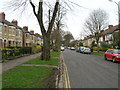
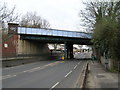
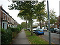

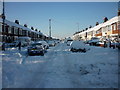


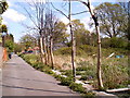
100 photos from this area
Area Information
Key information about the HU5 3JT including its size, population, and administrative classification.
- Area Type
- Postcode
- Area Size
- 1.2 hectares
- Population
- 1548
- Population Density
- 4962 people/km²
House Prices in HU5 3JT
37
Properties
£197,488
Average Sold Price
£49,950
Lowest Price
£395,000
Highest Price
Showing 37 properties
| Address | Type | Beds | Baths | Last Sale Price | Last Sale Date | |
|---|---|---|---|---|---|---|
| 56 Marlborough Avenue, Princes Avenue, Kingston Upon Hull, HU5 3JT | Semi-detached | 4 | 2 | £395,000 | Mar 2025 | |
| 90 Marlborough Avenue, Princes Avenue, Kingston Upon Hull, HU5 3JT | Terraced | - | - | £260,000 | Nov 2022 | |
| 82 Marlborough Avenue, Princes Avenue, Kingston Upon Hull, HU5 3JT | Terraced | 5 | 1 | £310,000 | Feb 2022 | |
| 92 Marlborough Avenue, Princes Avenue, Kingston Upon Hull, HU5 3JT | house | - | - | £300,000 | Oct 2020 | |
| 60 Marlborough Avenue, Princes Avenue, Kingston Upon Hull, HU5 3JT | house | 4 | - | £229,950 | Jan 2020 | |
| 80 Marlborough Avenue, Princes Avenue, Kingston Upon Hull, HU5 3JT | Terraced | 5 | - | £225,000 | Feb 2017 | |
| 94 Marlborough Avenue, Princes Avenue, Kingston Upon Hull, HU5 3JT | house | 5 | 2 | £246,000 | Oct 2013 | |
| 108 Marlborough Avenue, Princes Avenue, Kingston Upon Hull, HU5 3JT | Terraced | 4 | - | £135,000 | Feb 2013 | |
| 78 Marlborough Avenue, Princes Avenue, Kingston Upon Hull, HU5 3JT | Terraced | 5 | 1 | £220,000 | Jul 2012 | |
| 88 Marlborough Avenue, Princes Avenue, Kingston Upon Hull, HU5 3JT | Terraced | - | - | £191,500 | Jul 2006 |
Page 1 of 4
Energy Efficiency in HU5 3JT
Amenities
Schools
| Rank | School | Type | Entry gender | Ages |
|---|
Explore more schools in this area
Go to Schools tabDemographics
Household Size
One person
most common
Accommodation Type
Houses
most common
Tenure
65
majority
Ethnic Group
White
most common
Religion
N/A
most common
Household Composition
N/A
most common
Age
47
median
Adults (30-64 years)
most common
Household Deprivation
N/A
with no deprivation
NS-SEC
45
in Lower managerial occupations
Explore more demographic insights in this area
Go to Demographics tabPlanning
Planning Constraints
- Flood RiskPremium
- Ramsar Wetland SitesPremium
- Area of Outstanding Natural BeautyPremium
- Protected Nature ReservePremium
- Protected WoodlandPremium