Area Overview for HU5 3DS
Photos of HU5 3DS

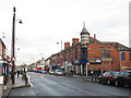
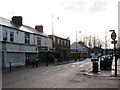
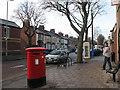
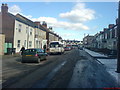
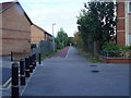
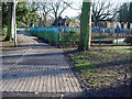
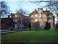
100 photos from this area
Area Information
Key information about the HU5 3DS including its size, population, and administrative classification.
- Area Type
- Postcode
- Area Size
- 1.4 hectares
- Population
- 1357
- Population Density
- 6634 people/km²
House Prices in HU5 3DS
38
Properties
£229,952
Average Sold Price
£59,950
Lowest Price
£385,000
Highest Price
Showing 38 properties
| Address | Type | Beds | Baths | Last Sale Price | Last Sale Date | |
|---|---|---|---|---|---|---|
| 70 Victoria Avenue, Princes Avenue, Kingston Upon Hull, HU5 3DS | house | 5 | 2 | £385,000 | Feb 2024 | |
| 58 Victoria Avenue, Princes Avenue, Kingston Upon Hull, HU5 3DS | house | 5 | - | £340,000 | Apr 2022 | |
| 76 Victoria Avenue, Princes Avenue, Kingston Upon Hull, HU5 3DS | house | - | - | £316,000 | Jan 2022 | |
| 90 Victoria Avenue, Princes Avenue, Kingston Upon Hull, HU5 3DS | Semi-detached | 3 | 2 | £266,000 | Nov 2021 | |
| 68 Victoria Avenue, Princes Avenue, Kingston Upon Hull, HU5 3DS | house | - | - | £295,000 | Jan 2021 | |
| 80 Victoria Avenue, Princes Avenue, Kingston Upon Hull, HU5 3DS | Terraced | 3 | 2 | £280,000 | Apr 2019 | |
| 66 Victoria Avenue, Princes Avenue, Kingston Upon Hull, HU5 3DS | house | 4 | - | £280,000 | Mar 2019 | |
| 112 Victoria Avenue, Princes Avenue, Kingston Upon Hull, HU5 3DS | Terraced | 5 | 1 | £252,000 | Nov 2017 | |
| 114 Victoria Avenue, Princes Avenue, Kingston Upon Hull, HU5 3DS | house | 5 | - | £225,000 | Sep 2017 | |
| 86 Victoria Avenue, Princes Avenue, Kingston Upon Hull, HU5 3DS | Terraced | 4 | 1 | £253,000 | Mar 2017 |
Page 1 of 4
Energy Efficiency in HU5 3DS
Amenities
Schools
| Rank | School | Type | Entry gender | Ages |
|---|
Explore more schools in this area
Go to Schools tabDemographics
Household Size
Two person
most common
Accommodation Type
Houses
most common
Tenure
66
majority
Ethnic Group
White
most common
Religion
N/A
most common
Household Composition
N/A
most common
Age
47
median
Adults (30-64 years)
most common
Household Deprivation
N/A
with no deprivation
NS-SEC
43
in Lower managerial occupations
Explore more demographic insights in this area
Go to Demographics tabPlanning
Planning Constraints
- Flood RiskPremium
- Ramsar Wetland SitesPremium
- Area of Outstanding Natural BeautyPremium
- Protected Nature ReservePremium
- Protected WoodlandPremium