Area Overview for HU5 2YT
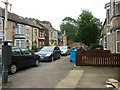
Photos of HU5 2YT


Area Information
Living in HU5 2YT means being part of a small, tightly knit residential cluster in England with a population of 1701. This area is characterised by its proximity to essential services and transport links, making it practical for daily life. The community is predominantly young, with a median age of 22 and most residents falling into the 15–29 age bracket. This suggests a dynamic, possibly student or early-career population. Daily life here is shaped by nearby amenities such as Sainsburys Newland, Hull Railway Station, and the Hull Ferry Terminal, which provide convenience for shopping, commuting, and travel. While the area lacks large-scale attractions, its compact size ensures that residents can access key facilities within walking or short driving distance. The presence of multiple rail stations and a ferry terminal also connects HU5 2YT to broader regional networks, enhancing its appeal for those reliant on public transport. However, the area’s small footprint means its housing stock is limited, and buyers should consider the local context when exploring properties.
- Area Type
- Postcode
- Area Size
- Not available
- Population
- 1701
- Population Density
- 11074 people/km²
The property market in HU5 2YT is shaped by its small size and low home ownership rate of 23%. This suggests that the area is primarily a rental market, with houses forming the dominant accommodation type. The limited housing stock means that buyers may find few opportunities for purchase, and competition for available properties could be intense. The low home ownership percentage also indicates that the area may not be ideal for those seeking long-term investment in property. However, the presence of multiple rail stations and proximity to retail hubs like Sainsburys Newland and Tesco Hull could make it attractive for renters prioritising convenience. For buyers, the small footprint of HU5 2YT means that the immediate surrounding areas are likely to be critical for finding additional housing options.
House Prices in HU5 2YT
No properties found in this postcode.
Energy Efficiency in HU5 2YT
The lifestyle in HU5 2YT is defined by its practical amenities and proximity to essential services. Residents have access to five retail outlets, including Sainsburys Newland, Heron Newland, and Tesco Hull, providing convenience for shopping and daily errands. The rail network, with stations such as Hull and Cottingham, connects the area to broader regional hubs, while the Hull Ferry Terminal offers direct links to nearby destinations. Though the data does not mention parks or leisure facilities, the presence of multiple retail and transport options suggests a focus on functionality over leisure. This makes HU5 2YT suitable for those prioritising accessibility and practicality in their daily lives. The compact nature of the area means that residents can reach key services quickly, though those seeking larger recreational spaces may need to look beyond the immediate vicinity.
Amenities
Schools
The nearest schools to HU5 2YT include Sidmouth Primary School, which serves the primary education needs of local children. While the data lists this school twice, it is likely a single institution with multiple entries. The absence of secondary schools in the data suggests that families with older children may need to look beyond HU5 2YT for secondary education. The availability of a primary school is a key consideration for parents, though the lack of detailed information on Ofsted ratings or academic performance means that further research would be necessary to assess the quality of education. For those prioritising proximity to schools, the presence of Sidmouth Primary School offers a practical advantage, but the limited range of educational institutions highlights the need to consider broader regional options.
| Rank | School | Type | Entry gender | Ages |
|---|
Explore more schools in this area
Go to Schools tabDemographics
The demographic profile of HU5 2YT reflects a young, transient population. With a median age of 22 and the majority of residents aged 15–29, the area is dominated by young adults, often students or early-career professionals. Home ownership is low at 23%, indicating that most residents rent their accommodation. The predominant housing type is houses, though the exact number of properties is not specified. The ethnic composition is largely White, with no data provided on other groups. This age profile suggests a community focused on short-term living, possibly influenced by nearby educational institutions or employment opportunities. The low home ownership rate may also reflect the area’s role as a transitional or rental-focused zone. For those considering HU5 2YT, understanding the transient nature of the population is key to assessing its long-term stability and community dynamics.
Household Size
Accommodation Type
Tenure
Ethnic Group
Religion
Household Composition
Age
Household Deprivation
NS-SEC
Explore more demographic insights in this area
Go to Demographics tabPlanning
Planning Constraints
- Flood RiskPremium
- Ramsar Wetland SitesPremium
- Area of Outstanding Natural BeautyPremium
- Protected Nature ReservePremium
- Protected WoodlandPremium