Area Overview for HU5 1RU
Photos of HU5 1RU


Area Information
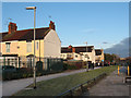
Living in HU5 1RU means inhabiting a tightly packed residential cluster in England, where 1,737 people reside across just 3.5 hectares. This results in a staggering population density of 49,238 people per square kilometre, making it one of the most densely populated areas in the UK. The community here is predominantly adults aged 30–64, with a median age of 47. Daily life is shaped by proximity to essential services, though the area’s compact size means every destination is within walking or short driving distance. The presence of multiple rail stations, including Hull and Cottingham, ensures strong transport links, while nearby retail hubs like Tesco Hull and Asda Ferry cater to everyday needs. However, the area’s small footprint also means limited green space and a focus on housing over commercial development. For those prioritising convenience over space, HU5 1RU offers a compact, connected environment, though its high density may appeal more to those seeking proximity to amenities than expansive living areas.
- Area Type
- Postcode
- Area Size
- 3.5 hectares
- Population
- 1737
- Population Density
- 2961 people/km²
The property market in HU5 1RU is characterised by low home ownership, with only 18% of residents owning their homes. This suggests a rental-dominated market, where the majority of housing is occupied by tenants. The accommodation type is predominantly houses, though the area’s small size and high density imply that these properties are likely to be smaller, multi-occupancy homes. Given the limited land area and the focus on residential use, the housing stock is unlikely to include large detached homes or modern developments. For buyers, this means opportunities are constrained to the existing housing stock, which may be limited in both quantity and variety. The area’s proximity to transport links and retail hubs could make it attractive to investors, but the low home ownership rate suggests competition for available properties. Buyers should also consider the challenges of living in such a densely populated area, where space and privacy may be at a premium.
House Prices in HU5 1RU
Showing 1 properties
| Address | Type | Beds | Baths | Last Sale Price | Last Sale Date | |
|---|---|---|---|---|---|---|
| Rm Stores, Crown Paints, Sculcoates Lane, Kingston Upon Hull, HU5 1RU | warehouse | - | - | - | - |
Energy Efficiency in HU5 1RU
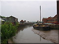
The lifestyle in HU5 1RU is shaped by its proximity to retail, transport, and essential services. Within walking distance are multiple supermarkets, including Tesco Hull and Asda Ferry, ensuring everyday shopping needs are met. The area’s rail network, with stations such as Hull and New Holland, provides easy access to commuting routes, while the Hull Ferry Terminal offers an alternative for those preferring maritime travel. Though the data does not mention parks or leisure facilities, the compact nature of the area suggests that residents may rely on nearby urban amenities for recreation. The presence of multiple retail outlets and transport hubs indicates a community focused on convenience, where daily life is centred around accessibility rather than expansive leisure options. For those who value proximity to services and efficient transport, HU5 1RU offers a practical, if densely populated, environment.
Amenities
Schools
The nearest schools to HU5 1RU include Stepney Primary School, which serves as the primary education provider for the area. The school is listed twice in the data, with one entry noting an Ofsted rating of 'good'. This suggests that the primary education available is of acceptable quality, though the absence of secondary schools in the data means families with older children may need to look beyond the immediate vicinity for secondary education. The concentration of primary schools indicates that the area is well-served for younger children, but the lack of diversity in school types—only primary schools are mentioned—may limit options for families requiring a broader range of educational facilities. Parents should investigate further for secondary school options, as the data does not provide details on their availability or quality.
| Rank | School | Type | Entry gender | Ages |
|---|
Explore more schools in this area
Go to Schools tabDemographics
The community in HU5 1RU is defined by its age profile and housing patterns. With a median age of 47 and the majority of residents falling within the 30–64 age range, this is a mature demographic, suggesting a population of working-age adults and older homeowners. Home ownership is relatively low at 18%, indicating that most residents are likely to be renters, possibly due to the area’s compact size and limited housing stock. The predominant accommodation type is houses, though the high population density suggests these are often multi-generational or shared dwellings. The predominant ethnic group is White, with no specific data on diversity beyond this. The high density, combined with the age profile, points to a community that may prioritise proximity to services over expansive living space. However, the lack of detailed data on deprivation or income levels means the quality of life implications of these figures remain partially opaque.
Household Size
Accommodation Type
Tenure
Ethnic Group
Religion
Household Composition
Age
Household Deprivation
NS-SEC
Explore more demographic insights in this area
Go to Demographics tabPlanning
Planning Constraints
- Flood RiskPremium
- Ramsar Wetland SitesPremium
- Area of Outstanding Natural BeautyPremium
- Protected Nature ReservePremium
- Protected WoodlandPremium