Area Overview for HU4 7RG
Photos of HU4 7RG

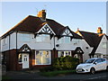

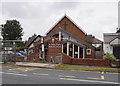

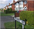
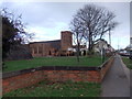
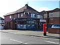
67 photos from this area
Area Information
Key information about the HU4 7RG including its size, population, and administrative classification.
- Area Type
- Postcode
- Area Size
- 2.2 hectares
- Population
- 1337
- Population Density
- 5790 people/km²
House Prices in HU4 7RG
48
Properties
£136,591
Average Sold Price
£41,500
Lowest Price
£235,000
Highest Price
Showing 48 properties
| Address | Type | Beds | Baths | Last Sale Price | Last Sale Date | |
|---|---|---|---|---|---|---|
| 25 Sherwood Drive, Anlaby Common, HU4 7RG | Semi-detached | 3 | 1 | £225,000 | Mar 2025 | |
| 51 Sherwood Drive, Anlaby Common, HU4 7RG | Semi-detached | 3 | 1 | £225,000 | Aug 2024 | |
| 59 Sherwood Drive, Anlaby Common, HU4 7RG | Semi-detached | 2 | 1 | £155,000 | Jan 2023 | |
| 3 Sherwood Drive, Anlaby Common, HU4 7RG | Semi-detached | 3 | 1 | £235,000 | Dec 2022 | |
| 11 Sherwood Drive, Anlaby Common, HU4 7RG | Semi-detached | 3 | 1 | £180,000 | Mar 2022 | |
| 91 Sherwood Drive, Anlaby Common, HU4 7RG | Bungalow | - | - | £200,000 | Dec 2021 | |
| 61 Sherwood Drive, Anlaby Common, HU4 7RG | Bungalow | - | - | £220,000 | Jul 2021 | |
| 47 Sherwood Drive, Anlaby Common, HU4 7RG | Semi-detached | 3 | 1 | £176,950 | Sep 2019 | |
| 55 Sherwood Drive, Anlaby Common, HU4 7RG | Semi-detached | 2 | 1 | £90,000 | Mar 2019 | |
| 41 Sherwood Drive, Anlaby Common, HU4 7RG | Semi-detached | 3 | 1 | £168,500 | May 2018 |
Page 1 of 5
Energy Efficiency in HU4 7RG
Amenities
Schools
| Rank | School | Type | Entry gender | Ages |
|---|
Explore more schools in this area
Go to Schools tabDemographics
Household Size
Two person
most common
Accommodation Type
Houses
most common
Tenure
88
majority
Ethnic Group
White
most common
Religion
N/A
most common
Household Composition
N/A
most common
Age
47
median
Adults (30-64 years)
most common
Household Deprivation
N/A
with no deprivation
NS-SEC
29
in Lower managerial occupations
Explore more demographic insights in this area
Go to Demographics tabPlanning
Planning Constraints
- Flood RiskPremium
- Ramsar Wetland SitesPremium
- Area of Outstanding Natural BeautyPremium
- Protected Nature ReservePremium
- Protected WoodlandPremium