Area Overview for HU4 6XR
Photos of HU4 6XR


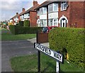

67 photos from this area
Area Information
Key information about the HU4 6XR including its size, population, and administrative classification.
- Area Type
- Postcode
- Area Size
- 1.3 hectares
- Population
- 1507
- Population Density
- 5253 people/km²
House Prices in HU4 6XR
30
Properties
£139,533
Average Sold Price
£48,000
Lowest Price
£306,000
Highest Price
Showing 30 properties
| Address | Type | Beds | Baths | Last Sale Price | Last Sale Date | |
|---|---|---|---|---|---|---|
| 35 The Roundway, Kingston Upon Hull, HU4 6XR | house | - | - | £220,000 | May 2023 | |
| 70 The Roundway, Kingston Upon Hull, HU4 6XR | Semi-detached | 4 | - | £306,000 | Sep 2022 | |
| 68 The Roundway, Kingston Upon Hull, HU4 6XR | house | - | - | £209,000 | Jul 2022 | |
| 56 The Roundway, Kingston Upon Hull, HU4 6XR | house | - | - | £188,000 | Jul 2020 | |
| 60 The Roundway, Kingston Upon Hull, HU4 6XR | Semi-detached | 3 | 1 | £150,000 | May 2016 | |
| 48 The Roundway, Kingston Upon Hull, HU4 6XR | Semi-detached | - | - | £171,000 | Jan 2010 | |
| 66 The Roundway, Kingston Upon Hull, HU4 6XR | Semi-detached | - | - | £140,000 | Dec 2009 | |
| 72 The Roundway, Kingston Upon Hull, HU4 6XR | Semi-detached | - | - | £150,000 | Sep 2007 | |
| 50 The Roundway, Kingston Upon Hull, HU4 6XR | Semi-detached | - | - | £184,000 | Oct 2004 | |
| 39 The Roundway, Kingston Upon Hull, HU4 6XR | Semi-detached | - | - | £73,000 | Oct 2002 |
Page 1 of 3
Energy Efficiency in HU4 6XR
Amenities
Schools
| Rank | School | Type | Entry gender | Ages |
|---|
Explore more schools in this area
Go to Schools tabDemographics
Household Size
Family (3-5 people)
most common
Accommodation Type
Houses
most common
Tenure
91
majority
Ethnic Group
White
most common
Religion
N/A
most common
Household Composition
N/A
most common
Age
47
median
Adults (30-64 years)
most common
Household Deprivation
N/A
with no deprivation
NS-SEC
36
in Lower managerial occupations
Explore more demographic insights in this area
Go to Demographics tabPlanning
Planning Constraints
- Flood RiskPremium
- Ramsar Wetland SitesPremium
- Area of Outstanding Natural BeautyPremium
- Protected Nature ReservePremium
- Protected WoodlandPremium