Area Overview for HU4 6XL
Photos of HU4 6XL

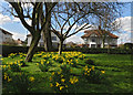

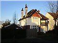
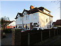
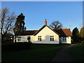
100 photos from this area
Area Information
Key information about the HU4 6XL including its size, population, and administrative classification.
- Area Type
- Postcode
- Area Size
- 1.3 hectares
- Population
- 1507
- Population Density
- 5253 people/km²
House Prices in HU4 6XL
20
Properties
£165,954
Average Sold Price
£54,000
Lowest Price
£320,000
Highest Price
Showing 20 properties
| Address | Type | Beds | Baths | Last Sale Price | Last Sale Date | |
|---|---|---|---|---|---|---|
| 9 Mead Walk, Kingston Upon Hull, HU4 6XL | Semi-detached | 3 | 1 | £320,000 | Jan 2025 | |
| 6 Mead Walk, Kingston Upon Hull, HU4 6XL | Semi-detached | 3 | 1 | £243,000 | Jun 2021 | |
| 19 Mead Walk, Kingston Upon Hull, HU4 6XL | house | - | - | £210,000 | Jun 2021 | |
| 8 Mead Walk, Kingston Upon Hull, HU4 6XL | Semi-detached | 3 | 1 | £214,000 | Feb 2020 | |
| 16 Mead Walk, Kingston Upon Hull, HU4 6XL | Semi-detached | 4 | 1 | £180,000 | Sep 2011 | |
| 15 Mead Walk, Kingston Upon Hull, HU4 6XL | Semi-detached | - | - | £185,000 | Apr 2007 | |
| 11 Mead Walk, Kingston Upon Hull, HU4 6XL | Semi-detached | - | - | £176,500 | Aug 2005 | |
| 2 Mead Walk, Kingston Upon Hull, HU4 6XL | house | - | - | £180,000 | Dec 2004 | |
| 17 Mead Walk, Kingston Upon Hull, HU4 6XL | Semi-detached | - | - | £81,000 | Nov 1999 | |
| 4 Mead Walk, Kingston Upon Hull, HU4 6XL | Semi-detached | - | - | £59,950 | Jun 1998 |
Page 1 of 2
Energy Efficiency in HU4 6XL
Amenities
Schools
| Rank | School | Type | Entry gender | Ages |
|---|
Explore more schools in this area
Go to Schools tabDemographics
Household Size
Family (3-5 people)
most common
Accommodation Type
Houses
most common
Tenure
91
majority
Ethnic Group
White
most common
Religion
N/A
most common
Household Composition
N/A
most common
Age
47
median
Adults (30-64 years)
most common
Household Deprivation
N/A
with no deprivation
NS-SEC
36
in Lower managerial occupations
Explore more demographic insights in this area
Go to Demographics tabPlanning
Planning Constraints
- Flood RiskPremium
- Ramsar Wetland SitesPremium
- Area of Outstanding Natural BeautyPremium
- Protected Nature ReservePremium
- Protected WoodlandPremium