Area Overview for HU4 6PE
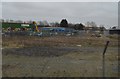
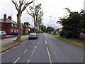
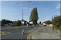
Photos of HU4 6PE


Area Information
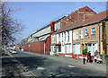
Living in HU4 6PE means being part of a small, tightly knit residential cluster in England, home to 1,604 residents. The area is defined by its compact size and proximity to key transport links, including multiple railway stations and a ferry terminal. Daily life here is shaped by its modest scale, with a population skewed toward adults aged 30–64, reflecting a community of settled professionals and families. The area’s low flood risk and absence of environmental constraints like protected woodlands or AONB designations make it a practical choice for those prioritising safety and planning certainty. While the housing stock is predominantly houses, the 30% home ownership rate suggests a mix of rental and owner-occupied properties. Residents benefit from excellent broadband connectivity, scoring 100 out of 100, and strong rail links to Hull and beyond. This postcode is ideal for those seeking a quiet, functional base with easy access to urban amenities without the density of larger towns.
- Area Type
- Postcode
- Area Size
- Not available
- Population
- 1604
- Population Density
- 4368 people/km²
The property market in HU4 6PE is characterised by a 30% home ownership rate, suggesting that most residents rent their homes. The area’s housing stock is predominantly houses, which contrasts with regions where flats or apartments dominate. This indicates a traditional, low-density residential environment, likely appealing to those seeking single-family homes. However, the small size of the postcode and its limited housing stock mean that buyers should consider the broader surrounding area for more options. The 30% ownership rate also implies a rental market that may be competitive, with landlords potentially holding a significant share of properties. For buyers, the area’s compact nature means proximity to transport and amenities is a key advantage, though the limited scale of the postcode may restrict availability.
House Prices in HU4 6PE
No properties found in this postcode.
Energy Efficiency in HU4 6PE
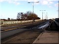
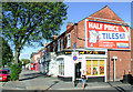
Residents of HU4 6PE have access to a range of nearby amenities, including five retail venues such as Heron Anlaby, Makro Hull, and Lidl Brighton. These shops provide convenience for everyday shopping, from groceries to general retail. The area’s rail network, with stations like Hull Railway Station and Barrow Haven Railway Station, ensures easy access to urban centres, while the Hull Ferry Terminal offers maritime connectivity. Though the area is small, the proximity to these amenities means residents can enjoy a mix of practicality and accessibility. The retail options and transport links contribute to a lifestyle that balances convenience with the ability to travel further afield for leisure or work.
Amenities
Schools
| Rank | School | Type | Entry gender | Ages |
|---|
Explore more schools in this area
Go to Schools tabDemographics
The community in HU4 6PE is predominantly composed of adults aged 30–64, with a median age of 47. This suggests a population of settled professionals and families, rather than a younger or elderly demographic. Home ownership stands at 30%, indicating a majority of residents rent their homes. The area’s accommodation is largely houses, reflecting a traditional housing stock rather than flats or apartments. The predominant ethnic group is White, though no data is provided on the presence of other ethnicities or diversity metrics. The 30% home ownership rate implies a rental market that may offer flexibility for those seeking short-term or transitional housing. The absence of specific data on deprivation or socioeconomic status means the area’s quality of life can only be inferred from its infrastructure and amenities.
Household Size
Accommodation Type
Tenure
Ethnic Group
Religion
Household Composition
Age
Household Deprivation
NS-SEC
Explore more demographic insights in this area
Go to Demographics tabPlanning
Planning Constraints
- Flood RiskPremium
- Ramsar Wetland SitesPremium
- Area of Outstanding Natural BeautyPremium
- Protected Nature ReservePremium
- Protected WoodlandPremium