Area Overview for HU4 6AH
Photos of HU4 6AH

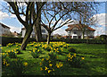
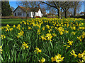
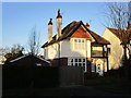
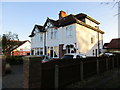
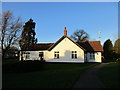
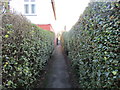
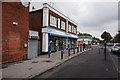
100 photos from this area
Area Information
Key information about the HU4 6AH including its size, population, and administrative classification.
- Area Type
- Postcode
- Area Size
- 1.5 hectares
- Population
- 1544
- Population Density
- 4329 people/km²
House Prices in HU4 6AH
15
Properties
£257,500
Average Sold Price
£235,000
Lowest Price
£280,000
Highest Price
Showing 15 properties
| Address | Type | Beds | Baths | Last Sale Price | Last Sale Date | |
|---|---|---|---|---|---|---|
| 944 Anlaby Road, Kingston Upon Hull, HU4 6AH | Terraced | 4 | 2 | £280,000 | Jun 2023 | |
| 968 Anlaby Road, Kingston Upon Hull, HU4 6AH | Detached | 4 | - | £235,000 | Aug 2014 | |
| Flat At, 962 Anlaby Road, Kingston Upon Hull, HU4 6AH | Terraced | 3 | - | - | - | |
| Flat, 952 Anlaby Road, Kingston Upon Hull, HU4 6AH | Flat | 2 | 1 | - | - | |
| Flat At, 954 Anlaby Road, Kingston Upon Hull, HU4 6AH | retail_financial | - | - | - | - | |
| Westfield Management Beverley Ltd, First Floor, 960 Anlaby Road, Kingston Upon Hull, HU4 6AH | Office | - | - | - | - | |
| Flat A, 958 Anlaby Road, Kingston Upon Hull, HU4 6AH | Flat | - | - | - | - | |
| Store Rear Of, 956 Anlaby Road, Kingston Upon Hull, HU4 6AH | Industrial | - | - | - | - | |
| 942 Anlaby Road, Kingston Upon Hull, HU4 6AH | house | - | - | - | - | |
| 956A Anlaby Road, Kingston Upon Hull, HU4 6AH | Flat | - | - | - | - |
Page 1 of 2
Energy Efficiency in HU4 6AH
Amenities
Schools
| Rank | School | Type | Entry gender | Ages |
|---|
Explore more schools in this area
Go to Schools tabDemographics
Household Size
One person
most common
Accommodation Type
Houses
most common
Tenure
42
majority
Ethnic Group
White
most common
Religion
N/A
most common
Household Composition
N/A
most common
Age
47
median
Adults (30-64 years)
most common
Household Deprivation
N/A
with no deprivation
NS-SEC
21
in Lower managerial occupations
Explore more demographic insights in this area
Go to Demographics tabPlanning
Planning Constraints
- Flood RiskPremium
- Ramsar Wetland SitesPremium
- Area of Outstanding Natural BeautyPremium
- Protected Nature ReservePremium
- Protected WoodlandPremium