Area Overview for HU3 6EB
Photos of HU3 6EB

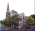


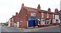

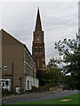


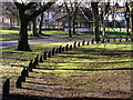
100 photos from this area
Area Information
Key information about the HU3 6EB including its size, population, and administrative classification.
- Area Type
- Postcode
- Area Size
- 8475 m²
- Population
- 1751
- Population Density
- 9324 people/km²
House Prices in HU3 6EB
48
Properties
£65,198
Average Sold Price
£11,000
Lowest Price
£130,000
Highest Price
Showing 48 properties
| Address | Type | Beds | Baths | Last Sale Price | Last Sale Date | |
|---|---|---|---|---|---|---|
| 24 Sandringham Street, Kingston Upon Hull, HU3 6EB | Terraced | 3 | 1 | £116,000 | Jan 2024 | |
| 32 Sandringham Street, Kingston Upon Hull, HU3 6EB | Terraced | 3 | 1 | £70,000 | Dec 2023 | |
| 60 Sandringham Street, Kingston Upon Hull, HU3 6EB | Terraced | 6 | 3 | £130,000 | Jun 2023 | |
| 66 Sandringham Street, Kingston Upon Hull, HU3 6EB | Retail | 3 | 1 | £125,000 | Oct 2022 | |
| 22 Sandringham Street, Kingston Upon Hull, HU3 6EB | house | - | - | £108,655 | Aug 2022 | |
| 30 Sandringham Street, Kingston Upon Hull, HU3 6EB | Terraced | 3 | 1 | £82,000 | Aug 2021 | |
| 74 Sandringham Street, Kingston Upon Hull, HU3 6EB | Terraced | 2 | 1 | £92,000 | Jan 2021 | |
| 54 Sandringham Street, Kingston Upon Hull, HU3 6EB | house | - | - | £75,000 | Nov 2018 | |
| 16 Sandringham Street, Kingston Upon Hull, HU3 6EB | Terraced | 3 | 1 | £85,500 | Nov 2017 | |
| 68 Sandringham Street, Kingston Upon Hull, HU3 6EB | house | 2 | - | £49,000 | Mar 2015 |
Page 1 of 5
Energy Efficiency in HU3 6EB
Amenities
Schools
| Rank | School | Type | Entry gender | Ages |
|---|
Explore more schools in this area
Go to Schools tabDemographics
Household Size
One person
most common
Accommodation Type
Houses
most common
Tenure
36
majority
Ethnic Group
White
most common
Religion
N/A
most common
Household Composition
N/A
most common
Age
47
median
Adults (30-64 years)
most common
Household Deprivation
N/A
with no deprivation
NS-SEC
16
in Lower managerial occupations
Explore more demographic insights in this area
Go to Demographics tabPlanning
Planning Constraints
- Flood RiskPremium
- Ramsar Wetland SitesPremium
- Area of Outstanding Natural BeautyPremium
- Protected Nature ReservePremium
- Protected WoodlandPremium