Area Overview for HU3 5LF
Photos of HU3 5LF
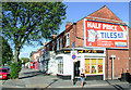
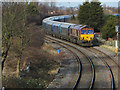
100 photos from this area
Area Information
Key information about the HU3 5LF including its size, population, and administrative classification.
- Area Type
- Postcode
- Area Size
- 1.6 hectares
- Population
- 2246
- Population Density
- 5182 people/km²
House Prices in HU3 5LF
49
Properties
£57,574
Average Sold Price
£29,950
Lowest Price
£75,000
Highest Price
Showing 49 properties
| Address | Type | Beds | Baths | Last Sale Price | Last Sale Date | |
|---|---|---|---|---|---|---|
| 117 Newington Street, Kingston Upon Hull, HU3 5LF | Terraced | 3 | - | £70,000 | Sep 2014 | |
| 147 Newington Street, Kingston Upon Hull, HU3 5LF | house | - | - | £75,000 | Jul 2010 | |
| 151 Newington Street, Kingston Upon Hull, HU3 5LF | Terraced | - | - | £30,500 | Jan 2008 | |
| 129 Newington Street, Kingston Upon Hull, HU3 5LF | house | - | - | £75,000 | Jan 2007 | |
| 155 Newington Street, Kingston Upon Hull, HU3 5LF | house | - | - | £64,995 | Dec 2006 | |
| 101 Newington Street, Kingston Upon Hull, HU3 5LF | Terraced | - | - | £29,950 | Oct 2002 | |
| 189 Newington Street, Kingston Upon Hull, HU3 5LF | Unknown | - | - | - | - | |
| 183 Newington Street, Kingston Upon Hull, HU3 5LF | Unknown | - | - | - | - | |
| 187 Newington Street, Kingston Upon Hull, HU3 5LF | Unknown | - | - | - | - | |
| 143 Newington Street, Kingston Upon Hull, HU3 5LF | house | - | - | - | - |
Page 1 of 5
Energy Efficiency in HU3 5LF
Amenities
Schools
| Rank | School | Type | Entry gender | Ages |
|---|
Explore more schools in this area
Go to Schools tabDemographics
Household Size
Family (3-5 people)
most common
Accommodation Type
Houses
most common
Tenure
38
majority
Ethnic Group
White
most common
Religion
N/A
most common
Household Composition
N/A
most common
Age
47
median
Adults (30-64 years)
most common
Household Deprivation
N/A
with no deprivation
NS-SEC
14
in Lower managerial occupations
Explore more demographic insights in this area
Go to Demographics tabPlanning
Planning Constraints
- Flood RiskPremium
- Ramsar Wetland SitesPremium
- Area of Outstanding Natural BeautyPremium
- Protected Nature ReservePremium
- Protected WoodlandPremium