Area Overview for HU3 4XP
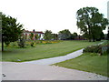
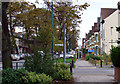
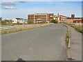
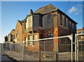
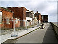
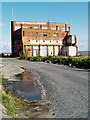
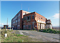
Photos of HU3 4XP


Area Information
Living in HU3 4XP means being part of a tightly knit residential cluster in England, where 1,627 people reside across a compact area. With a population density of 837 people per square kilometre, the community feels close-knit, though not overcrowded. This postcode area is defined by its modest scale and the presence of traditional housing stock. The median age of 47 suggests a mature population, with adults aged 30–64 forming the largest demographic group. Daily life here is shaped by proximity to local amenities, including retail outlets and transport links. The area’s small size means residents often know their neighbours, and the mix of homes and community spaces creates a distinct local character. While it lacks the vibrancy of larger urban centres, HU3 4XP offers a quiet, stable environment. Its location near rail networks and the Hull Ferry Terminal ensures connectivity to nearby towns and cities, making it practical for commuters. For those seeking a low-maintenance lifestyle with access to essential services, this area provides a straightforward, no-frills alternative to more densely populated regions.
- Area Type
- Postcode
- Area Size
- Not available
- Population
- 1627
- Population Density
- 837 people/km²
The property market in HU3 4XP is characterised by a low home ownership rate of 22%, suggesting that the area is more rental-focused than owner-occupied. The predominant accommodation type is houses, which is unusual in regions with higher rental rates, indicating a potential mismatch between housing stock and demand. This small postcode area likely has limited housing options, meaning buyers may need to look beyond the immediate vicinity for properties. The presence of houses suggests a preference for standalone homes, which could appeal to families or individuals seeking space. However, with only 22% of residents owning their homes, the market may be influenced by local employment opportunities and the availability of rental properties. For buyers, this implies that competition for homes in HU3 4XP could be limited, but the surrounding areas may offer more choices. The low home ownership rate also highlights the importance of considering rental yields or long-term investment potential in the region.
House Prices in HU3 4XP
No properties found in this postcode.
Energy Efficiency in HU3 4XP
Residents of HU3 4XP have access to a range of nearby amenities that support daily life. The retail sector includes Lidl Brighton, Asda Hessle, and Iceland Hessle, providing essential shopping options for groceries and household items. These stores ensure that residents can meet their practical needs without long trips. The area’s rail network, with stations such as Hull Railway Station and Barrow Haven Railway Station, offers convenient access to public transport, while the Hull Ferry Terminal adds flexibility for travel. Although the data does not mention parks or leisure facilities, the presence of multiple retail and transport hubs suggests a functional, practical lifestyle. The proximity to these amenities means that daily errands and commuting are efficient, reducing the need for car ownership. For those prioritising convenience and connectivity, HU3 4XP offers a straightforward, service-rich environment.
Amenities
Schools
Near HU3 4XP, families have access to a range of educational institutions, including Constable Primary School, which caters to younger children, and two other schools described as "other" types. The Boulevard Centre and The Venn Boulevard Centre are listed as non-primary institutions, though their specific functions are not detailed. The presence of a primary school ensures that young families have immediate access to early education, while the other schools may offer additional services or specialist provision. However, the lack of Ofsted ratings or specific descriptions means the quality of these institutions cannot be assessed from the data. For parents, the mix of school types provides some variety, but the absence of detailed information on academic performance or facilities means further research would be necessary to evaluate their suitability. The proximity of these schools to HU3 4XP suggests that education is a key consideration for families in the area.
| Rank | School | Type | Entry gender | Ages |
|---|
Explore more schools in this area
Go to Schools tabDemographics
The community in HU3 4XP is predominantly composed of adults aged 30–64, with a median age of 47. This suggests a mature population, likely with established careers and families. Home ownership is relatively low at 22%, indicating that a significant proportion of residents rent their homes. The accommodation type is primarily houses, which is uncommon in areas with higher rental rates, hinting at a mix of owner-occupied and rental properties. The predominant ethnic group is White, with no specific data on other demographics provided. The age profile and home ownership figures suggest a stable, long-term resident base rather than a transient population. The absence of detailed diversity statistics means the community’s composition remains largely defined by its core demographic. For buyers, this indicates a market where property values may be influenced by the local economy and the appeal of traditional housing. The low home ownership rate also suggests that rental demand could be a factor in property investment decisions.
Household Size
Accommodation Type
Tenure
Ethnic Group
Religion
Household Composition
Age
Household Deprivation
NS-SEC
Explore more demographic insights in this area
Go to Demographics tabPlanning
Planning Constraints
- Flood RiskPremium
- Ramsar Wetland SitesPremium
- Area of Outstanding Natural BeautyPremium
- Protected Nature ReservePremium
- Protected WoodlandPremium