Area Overview for HU3 4AS
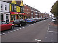
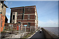
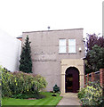
Photos of HU3 4AS


Area Information
Living in HU3 4AS means inhabiting a compact, residential postcode area in England with a population of 1,627 people spread over 2,315 square metres. This small cluster is densely populated, with 837 people per square kilometre, reflecting a tight-knit community. The area is characterised by its housing stock, with homes predominating over other accommodation types. Daily life here is shaped by proximity to essential services, including retail outlets, rail networks, and a ferry terminal. The demographic profile suggests a mature population, with a median age of 47 and most residents falling within the 30-64 age range. While the area’s small size limits sprawl, it offers a mix of practical amenities and connectivity, though challenges like flood risk and crime rates demand attention. For buyers, HU3 4AS presents a niche market where properties are likely to be owner-occupied or rented out, with a focus on homes rather than flats or apartments. The area’s appeal lies in its accessibility to transport links and retail options, though its environmental and safety risks must be weighed carefully.
- Area Type
- Postcode
- Area Size
- 2315 m²
- Population
- 1627
- Population Density
- 837 people/km²
The property market in HU3 4AS is defined by a low home ownership rate of 22%, suggesting that the area is largely a rental market rather than one dominated by owner-occupied homes. The accommodation type is predominantly houses, with no mention of flats or apartments in the data. This implies a housing stock that is likely to be older, with larger properties suited to families or individuals seeking more space. For buyers, this small area presents limited options, as the postcode covers only a residential cluster. The low home ownership rate may indicate a lack of long-term investment in property, potentially affecting property values and market stability. Buyers considering HU3 4AS should note that the area’s compact size and rental focus may limit opportunities for capital growth, though the presence of essential amenities and transport links could offset this. The market is likely to cater to those seeking rental properties or investment opportunities in a tightly bound community.
House Prices in HU3 4AS
No properties found in this postcode.
Energy Efficiency in HU3 4AS
Residents of HU3 4AS have access to a range of practical amenities within close proximity. The area is served by five retail outlets, including Asda Hessle and Budgens Hessle, providing essential shopping options. Rail connectivity is strong, with five stations such as Hull Railway Station and Barrow Haven Railway Station offering regular services. A ferry terminal at Hull adds to the area’s transport diversity, enabling travel across waterways. These amenities contribute to a functional lifestyle, with retail options and transport links supporting daily routines. The presence of multiple rail stations suggests ease of commuting, while the ferry terminal offers additional mobility. Though the data does not detail leisure or recreational facilities, the combination of retail and transport infrastructure indicates a focus on practicality over luxury. For those prioritising convenience and connectivity, HU3 4AS offers a compact environment with accessible services.
Amenities
Schools
Residents of HU3 4AS have access to a mix of educational institutions, including primary and other educational facilities. The nearby schools include Constable Primary School, which serves younger children, and two other centres named The Boulevard Centre and The Venn Boulevard Centre, though their specific educational roles are not detailed in the data. The presence of a primary school suggests that families with young children may find the area suitable for their needs, though the absence of secondary schools or detailed Ofsted ratings means that parents would need to investigate further for a complete picture. The combination of primary and other educational facilities indicates a varied approach to learning, but the lack of specific information on school performance or capacity means that prospective residents should seek additional insights when considering the area for family living.
| Rank | School | Type | Entry gender | Ages |
|---|
Explore more schools in this area
Go to Schools tabDemographics
The community in HU3 4AS is predominantly composed of adults aged 30-64, with a median age of 47. This suggests a population skewed towards middle-aged individuals, possibly reflecting a mix of long-term residents and families. Home ownership is relatively low at 22%, indicating that the majority of residents are likely to be renting. The area is primarily occupied by houses, with no data suggesting a significant presence of flats or other housing types. The predominant ethnic group is White, with no specific data on other demographics provided. The population density of 837 people per square kilometre implies a closely packed residential environment, which may influence social dynamics and local services. While the data does not specify deprivation levels, the low home ownership rate and high population density could indicate a reliance on rental markets and shared resources. This profile suggests a community that may prioritise practicality and affordability over luxury or exclusivity.
Household Size
Accommodation Type
Tenure
Ethnic Group
Religion
Household Composition
Age
Household Deprivation
NS-SEC
Explore more demographic insights in this area
Go to Demographics tabPlanning
Planning Constraints
- Flood RiskPremium
- Ramsar Wetland SitesPremium
- Area of Outstanding Natural BeautyPremium
- Protected Nature ReservePremium
- Protected WoodlandPremium