Area Overview for HU3 2RS
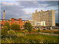
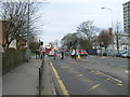
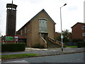
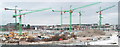
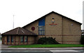
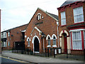
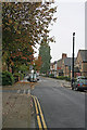
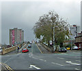
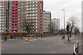
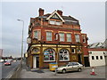
Photos of HU3 2RS


Area Information
Living in HU3 2RS means inhabiting a compact, densely populated residential cluster in England. With a population of 2,116 spread over just 1.3 hectares, the area is highly urbanised, creating a tight-knit community where proximity to amenities is a defining feature. The median age of 47 suggests a mature demographic, with most residents aged between 30 and 64. This is a place where daily life revolves around limited space but ample access to essential services. The area’s small footprint means residents are likely within walking distance of shops, transport hubs, and schools. While the high population density may feel restrictive, it also fosters a sense of immediacy in community interactions. For those considering homes in HU3 2RS, the compact nature of the area means every property is part of a tightly woven network of neighbours, with little room for expansion. The presence of nearby schools and transport links adds to its practical appeal, though the challenges of density are evident in both living conditions and infrastructure demands.
- Area Type
- Postcode
- Area Size
- 1.3 hectares
- Population
- 2116
- Population Density
- 4518 people/km²
The property market in HU3 2RS is characterised by a low home ownership rate of 19%, with flats being the sole accommodation type available. This suggests that the area is not a traditional owner-occupied market but rather a rental-focused environment. The limited housing stock, combined with the area’s small size, means there is little scope for property expansion or development. For buyers, this presents a challenge: the area is unlikely to offer a wide range of homes for purchase, and those available are likely to be flats in multi-unit buildings. The high population density further reinforces the idea that HU3 2RS is not suited to those seeking spacious or standalone properties. Buyers should consider whether the compact, rental-oriented nature of the area aligns with their long-term housing needs, particularly if they prioritise ownership or larger living spaces.
House Prices in HU3 2RS
Showing 1 properties
| Address | Type | Beds | Baths | Last Sale Price | Last Sale Date | |
|---|---|---|---|---|---|---|
| East Yorkshire Motor Services, 252-260 Anlaby Road, Kingston Upon Hull, HU3 2RS | Office | - | - | - | - |
Energy Efficiency in HU3 2RS
Life in HU3 2RS is shaped by its proximity to essential amenities. The area is within reach of five retail venues, including Budgens Anlaby and Tesco Hull, offering everyday shopping convenience. Rail connectivity is extensive, with five stations nearby, including Hull Railway Station, facilitating easy access to urban and regional destinations. The Hull Ferry Terminal adds another layer of mobility, enabling travel across the Humber Estuary. While the data does not specify parks or leisure facilities, the density of retail and transport options suggests a focus on practicality over leisure. The presence of multiple retail and transport hubs means residents can meet daily needs without significant travel. However, the lack of detailed information on parks or recreational spaces may indicate limited opportunities for outdoor activities, which could be a consideration for those prioritising green spaces.
Amenities
Schools
The nearest school to HU3 2RS is Adelaide Primary School, which serves the local community. As a primary school, it caters to younger children, though no secondary schools are listed in the data. The presence of a primary school within practical reach is a key consideration for families, offering convenience for parents and children. However, the absence of secondary schools nearby may require students to travel further for secondary education, which could impact daily routines. The single primary school listed suggests a limited educational infrastructure, which may be a factor for families prioritising a range of school options. For those living in HU3 2RS, the availability of Adelaide Primary School is a practical asset, but the lack of additional schools highlights a potential limitation in the area’s educational offerings.
| Rank | School | Type | Entry gender | Ages |
|---|
Explore more schools in this area
Go to Schools tabDemographics
The community in HU3 2RS is predominantly composed of adults aged 30 to 64, with a median age of 47. This reflects a mature, stable population with limited presence of younger or older demographics. Home ownership is low at 19%, indicating that the majority of residents are likely renters. The accommodation type is almost exclusively flats, which aligns with the area’s high population density of 166,856 people per square kilometre. This density, combined with the flat-dominated housing stock, suggests a focus on efficiency over space. The predominant ethnic group is White, with no data provided on other ethnicities. The lack of diversity may influence the social fabric, though the area’s compactness ensures a close-knit environment. The high proportion of adults in the workforce and the low home ownership rate imply a transient or rental-based population, which could affect long-term community stability.
Household Size
Accommodation Type
Tenure
Ethnic Group
Religion
Household Composition
Age
Household Deprivation
NS-SEC
Explore more demographic insights in this area
Go to Demographics tabPlanning
Planning Constraints
- Flood RiskPremium
- Ramsar Wetland SitesPremium
- Area of Outstanding Natural BeautyPremium
- Protected Nature ReservePremium
- Protected WoodlandPremium