Area Overview for HU3 2AD
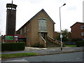
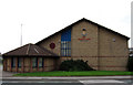
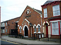
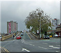
Photos of HU3 2AD


Area Information
Living in HU3 2AD means being part of a small, tightly knit residential cluster in England, with a population of just 2116 people. This area is defined by its compact size and proximity to key transport hubs, including Hull Railway Station and New Holland Railway Station, which provide direct links to the city and beyond. The community is predominantly composed of adults aged 30 to 64, reflecting a mature demographic that likely prioritises stability and accessibility. Daily life here is shaped by practical needs, with nearby amenities such as Asda Hessle and Hull Ferry Terminal offering convenience for shopping and travel. The area’s broadband connectivity is excellent, scoring 100, which supports remote work and digital lifestyles, though mobile coverage is slightly lower at 85. While HU3 2AD lacks natural or protected landscapes, its low flood risk and proximity to rail networks make it a pragmatic choice for those seeking a functional, if unremarkable, urban environment.
- Area Type
- Postcode
- Area Size
- Not available
- Population
- 2116
- Population Density
- 4518 people/km²
The property market in HU3 2AD is characterised by a low home ownership rate of 19%, suggesting that the area is primarily a rental market rather than one dominated by owner-occupied homes. The accommodation type is predominantly flats, which may indicate a mix of older residential buildings or purpose-built housing. This configuration is typical in areas with limited space or a focus on high-density living. For buyers, the small size of the area means that the housing stock is unlikely to offer a wide variety of options, and the presence of flats may appeal to those seeking manageable, low-maintenance properties. However, the low ownership rate could also signal a lack of long-term investment in the area, which may affect property values or future development potential. Prospective buyers should consider whether the rental-focused market aligns with their goals, particularly if they are seeking a home to live in rather than an asset to hold.
House Prices in HU3 2AD
No properties found in this postcode.
Energy Efficiency in HU3 2AD
Daily life in HU3 2AD is shaped by its proximity to essential amenities, including five retail outlets such as Asda Hessle, Iceland Hull, and Heron Hessle, which cater to everyday shopping needs. The rail network offers multiple stations, enabling easy access to the city and beyond, while the Hull Ferry Terminal adds another layer of connectivity for travel or commuting. Though the area lacks parks or leisure facilities, its practical amenities ensure that residents can meet most daily requirements without venturing far. The presence of multiple rail stations and a ferry terminal suggests a community that values mobility and accessibility, though the absence of green spaces or recreational areas may be a drawback for those prioritising outdoor activities. The combination of retail, transport, and digital connectivity creates a functional lifestyle, albeit one that leans heavily on urban infrastructure.
Amenities
Schools
The nearest school to HU3 2AD is Adelaide Primary School, a primary school that serves the local community. While no secondary schools are listed in the data, the presence of a primary school suggests that the area caters to families with younger children. However, the absence of higher education institutions or secondary schools may require residents to travel to nearby towns for secondary education. This could be a consideration for families planning long-term stays, as it may impact the convenience of schooling for older children. The school’s role in the community is likely significant, but without additional details on its performance or facilities, prospective residents must rely on local reputation or further research to assess its quality.
| Rank | School | Type | Entry gender | Ages |
|---|
Explore more schools in this area
Go to Schools tabDemographics
The community in HU3 2AD is predominantly middle-aged, with a median age of 47 and the most common age range being adults aged 30 to 64. This suggests a population that is largely established in careers and family life, with fewer young children or retirees. Home ownership is relatively low at 19%, indicating that the majority of residents are likely to be renters, possibly due to the area’s focus on flats as the primary accommodation type. The predominant ethnic group is White, which aligns with broader trends in the region. The low home ownership rate may reflect the nature of the housing stock—flats are more commonly rented than owned in such settings. This demographic profile implies a community that values convenience and proximity to services over long-term property investment, though it also means limited opportunities for homeownership.
Household Size
Accommodation Type
Tenure
Ethnic Group
Religion
Household Composition
Age
Household Deprivation
NS-SEC
Explore more demographic insights in this area
Go to Demographics tabPlanning
Planning Constraints
- Flood RiskPremium
- Ramsar Wetland SitesPremium
- Area of Outstanding Natural BeautyPremium
- Protected Nature ReservePremium
- Protected WoodlandPremium