Area Overview for HU3 1UB
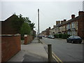
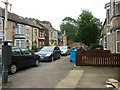
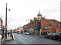
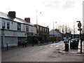
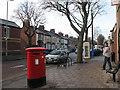
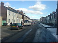
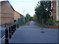
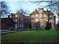
Photos of HU3 1UB


Area Information
Living in HU3 1UB means being part of a small, tightly knit residential cluster in England, home to around 1,750 people. The area is defined by its compact nature, with homes primarily in the form of houses rather than flats, catering to a community skewed towards adults aged 30–64. Daily life here is shaped by proximity to key amenities, including five retail outlets such as Asda Hull and Tesco Hull, and three railway stations—Hull, Cottingham, and New Holland—offering easy access to regional travel. The presence of Hull Ferry Terminal adds further connectivity, linking residents to nearby areas via water routes. While the population is modest, the area’s infrastructure supports a practical, functional lifestyle. The broadband score of 100 ensures seamless digital connectivity, though mobile coverage, while good, is not the strongest in the region. For those prioritising safety, the flood risk is negligible, but crime rates are notably above average, requiring heightened awareness. HU3 1UB is a place where convenience meets community, though its small size means every decision about living here carries a clear impact on the local environment.
- Area Type
- Postcode
- Area Size
- Not available
- Population
- 1750
- Population Density
- 6193 people/km²
The property market in HU3 1UB is characterised by a low home ownership rate of 22%, suggesting that the area is not a strong candidate for owner-occupied housing. Instead, it is likely a rental market, with the majority of properties occupied by tenants. The accommodation type is exclusively houses, which may indicate a preference for single-family homes over flats or apartments. This could be due to the area’s small size, which limits the availability of larger housing stock. For buyers considering the area, the limited number of properties means competition may be fierce, and the market is unlikely to cater to those seeking investment opportunities in rental properties. The focus on houses also means that properties are likely to be more spacious, though their condition and value would depend on individual factors. Given the low home ownership, buyers should approach the market with realistic expectations, recognising that this is not a region where property ownership is the norm.
House Prices in HU3 1UB
No properties found in this postcode.
Energy Efficiency in HU3 1UB
The lifestyle in HU3 1UB is shaped by its proximity to retail, transport, and community hubs. Residents have access to five retail outlets, including Asda Hull and Sainsburys Princes, offering everyday shopping needs within walking distance. The railway network, with stations such as Hull and Cottingham, provides easy access to regional centres, while the Hull Ferry Terminal connects the area to nearby locations by water. Though the data does not mention parks or leisure facilities, the presence of multiple retail and transport options suggests a practical, service-oriented lifestyle. The compact nature of the area means amenities are concentrated, reducing the need for long commutes. However, the absence of specific details about parks or recreational spaces means it is unclear whether the area supports outdoor activities. Overall, HU3 1UB offers a mix of convenience and accessibility, though its small size may limit the diversity of lifestyle options available.
Amenities
Schools
Residents of HU3 1UB have access to a range of educational institutions, including Pearson Primary School, which holds an Ofsted rating of ‘good’. Endeavour High School is listed as a primary school, though its rating is not specified, and Hull Trinity House Academy is an academy. The presence of both primary schools and an academy suggests a mix of traditional and alternative educational models, which may appeal to families seeking different approaches to schooling. Pearson Primary School’s ‘good’ rating indicates a satisfactory standard of education, though the lack of detailed ratings for other schools means potential buyers must investigate further. The proximity of these schools to the area means parents can reasonably expect a choice of options for their children. However, the absence of secondary school data means it is unclear whether the area supports a full educational journey from primary to secondary levels without commuting.
| Rank | School | Type | Entry gender | Ages |
|---|
Explore more schools in this area
Go to Schools tabDemographics
The community in HU3 1UB is predominantly composed of adults aged 30–64, with a median age of 47. This suggests a population largely in their prime working years, with fewer young families or retirees. Home ownership is low at 22%, indicating that the majority of residents are likely renting, which could reflect a mix of private and social housing. The area’s accommodation is exclusively houses, not flats, which may appeal to those seeking more space or privacy. The predominant ethnic group is White, with no data provided on other demographics. The low home ownership rate may influence the area’s character, fostering a transient population. For quality of life, the absence of significant deprivation data means it’s unclear how economic pressures affect residents, but the presence of nearby schools and transport links suggests basic needs are met. The age profile implies a community focused on stability and routine, with limited representation of younger or older age groups.
Household Size
Accommodation Type
Tenure
Ethnic Group
Religion
Household Composition
Age
Household Deprivation
NS-SEC
Explore more demographic insights in this area
Go to Demographics tabPlanning
Planning Constraints
- Flood RiskPremium
- Ramsar Wetland SitesPremium
- Area of Outstanding Natural BeautyPremium
- Protected Nature ReservePremium
- Protected WoodlandPremium