Area Overview for HU3 1TB
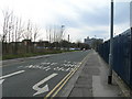
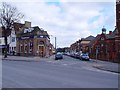
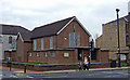
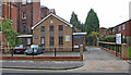
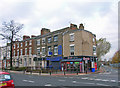
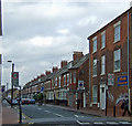
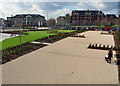
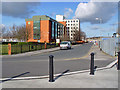
Photos of HU3 1TB


Area Information
Living in HU3 1TB means inhabiting a small, densely populated residential cluster in England. The area covers 2,652 square metres and is home to 1,750 people, resulting in a population density of 659,911 people per square kilometre — an unusually high figure that suggests compact, closely knit living. This postcode is characterised by its proximity to essential services, with five retail outlets, multiple rail stations, and a ferry terminal within practical reach. Daily life here is shaped by its proximity to Hull, a city with historical and economic significance. The area’s small size means it is likely to have a strong local identity, though the high density may influence the pace of life. Residents benefit from direct access to schools, transport networks, and retail hubs, making it a practical choice for those prioritising convenience. However, the area’s compact nature also means that any changes to infrastructure or services could have immediate, noticeable effects on the community.
- Area Type
- Postcode
- Area Size
- 2652 m²
- Population
- 1750
- Population Density
- 6193 people/km²
The property market in HU3 1TB is defined by its low home ownership rate (22%) and the prevalence of houses as the primary accommodation type. This suggests a rental market with limited owner-occupied properties, which could make it challenging for buyers seeking a long-term investment. The small area size means that housing stock is likely limited, and the immediate surroundings may offer more options. The presence of houses rather than flats or apartments indicates a traditional, perhaps older housing stock, which may appeal to those seeking larger living spaces. However, the low home ownership rate could also reflect economic factors, such as affordability issues or a lack of new developments. Buyers should consider the area’s compact nature and the potential for limited growth in property values.
House Prices in HU3 1TB
No properties found in this postcode.
Energy Efficiency in HU3 1TB
The lifestyle in HU3 1TB is shaped by its proximity to retail, transport, and community hubs. Residents have access to five retail outlets, including Asda Hull and Sainsburys Princes, providing everyday shopping convenience. The area’s rail network, with stations such as Hull and Cottingham, facilitates easy travel to nearby towns and cities. A ferry terminal at Hull adds flexibility for commuting or leisure trips. While the data does not specify parks or leisure facilities, the presence of multiple retail and transport options suggests a practical, service-oriented lifestyle. The compact nature of the area means that amenities are closely clustered, reducing the need for long journeys. However, the lack of detailed information on recreational spaces may indicate a focus on functional living over leisure.
Amenities
Schools
Residents of HU3 1TB have access to several educational institutions, including Pearson Primary School (Ofsted rating: good), Endeavour High School (primary), and Hull Trinity House Academy (academy). The mix of primary and academy schools provides options for families at different stages of education. Pearson Primary School’s good Ofsted rating suggests a reliable foundation for early learning, while the presence of an academy may offer specialist or alternative educational pathways. The proximity of these schools to the area ensures that families can access quality education without long commutes. However, the lack of secondary schools within the postcode itself may require residents to travel to nearby areas for high school education. The variety of school types reflects a balanced approach to meeting local educational needs.
| Rank | School | Type | Entry gender | Ages |
|---|
Explore more schools in this area
Go to Schools tabDemographics
The community in HU3 1TB is predominantly composed of adults aged 30–64, with a median age of 47. This suggests a mature, stable population, likely with established careers and families. Home ownership is low at 22%, indicating that a significant proportion of residents are renters, possibly due to the area’s limited housing stock or its status as a secondary residence. The accommodation type is primarily houses, which is uncommon in high-density areas, suggesting a mix of older properties and perhaps some recent developments. The predominant ethnic group is White, though no specific data on diversity or deprivation levels is provided. The age profile and home ownership figures imply a community that may prioritise stability over property investment, with a focus on long-term residency rather than speculative housing.
Household Size
Accommodation Type
Tenure
Ethnic Group
Religion
Household Composition
Age
Household Deprivation
NS-SEC
Explore more demographic insights in this area
Go to Demographics tabPlanning
Planning Constraints
- Flood RiskPremium
- Ramsar Wetland SitesPremium
- Area of Outstanding Natural BeautyPremium
- Protected Nature ReservePremium
- Protected WoodlandPremium