Area Overview for HU17 9DP
Photos of HU17 9DP
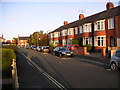
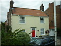
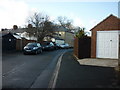
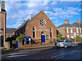

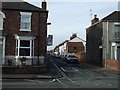
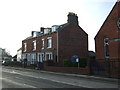
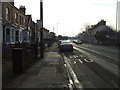
100 photos from this area
Area Information
Key information about the HU17 9DP including its size, population, and administrative classification.
- Area Type
- Postcode
- Area Size
- 8937 m²
- Population
- 1509
- Population Density
- 4837 people/km²
House Prices in HU17 9DP
19
Properties
£107,555
Average Sold Price
£25,200
Lowest Price
£215,000
Highest Price
Showing 19 properties
| Address | Type | Beds | Baths | Last Sale Price | Last Sale Date | |
|---|---|---|---|---|---|---|
| 75 Coltman Avenue, Beverley, HU17 9DP | house | 3 | 1 | £215,000 | Sep 2025 | |
| 93 Coltman Avenue, Beverley, HU17 9DP | Semi-detached | 4 | 2 | £199,500 | May 2025 | |
| 109 Coltman Avenue, Beverley, HU17 9DP | house | - | - | £150,000 | Mar 2022 | |
| 83 Coltman Avenue, Beverley, HU17 9DP | Semi-detached | 3 | 1 | £119,000 | Feb 2019 | |
| 77 Coltman Avenue, Beverley, HU17 9DP | Semi-detached | 3 | - | £88,000 | Mar 2006 | |
| 107 Coltman Avenue, Beverley, HU17 9DP | Semi-detached | - | - | £25,200 | Sep 2001 | |
| 87 Coltman Avenue, Beverley, HU17 9DP | Semi-detached | 3 | 1 | £25,740 | Jul 2000 | |
| 105 Coltman Avenue, Beverley, HU17 9DP | Semi-detached | - | - | £38,000 | Oct 1998 | |
| 95 Coltman Avenue, Beverley, HU17 9DP | house | - | - | - | - | |
| 91 Coltman Avenue, Beverley, HU17 9DP | house | - | - | - | - |
Page 1 of 2
Energy Efficiency in HU17 9DP
Amenities
Schools
| Rank | School | Type | Entry gender | Ages |
|---|
Explore more schools in this area
Go to Schools tabDemographics
Household Size
One person
most common
Accommodation Type
Houses
most common
Tenure
37
majority
Ethnic Group
White
most common
Religion
N/A
most common
Household Composition
N/A
most common
Age
47
median
Adults (30-64 years)
most common
Household Deprivation
N/A
with no deprivation
NS-SEC
25
in Lower managerial occupations
Explore more demographic insights in this area
Go to Demographics tabPlanning
Planning Constraints
- Flood RiskPremium
- Ramsar Wetland SitesPremium
- Area of Outstanding Natural BeautyPremium
- Protected Nature ReservePremium
- Protected WoodlandPremium