Area Overview for HU17 8SA
Photos of HU17 8SA
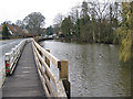
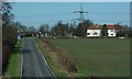
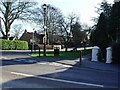
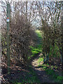
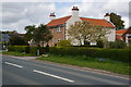
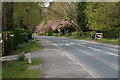
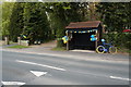
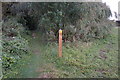
33 photos from this area
Area Information
Key information about the HU17 8SA including its size, population, and administrative classification.
- Area Type
- Postcode
- Area Size
- 3.0 hectares
- Population
- 1458
- Population Density
- 68 people/km²
House Prices in HU17 8SA
30
Properties
£246,097
Average Sold Price
£64,300
Lowest Price
£390,000
Highest Price
Showing 30 properties
| Address | Type | Beds | Baths | Last Sale Price | Last Sale Date | |
|---|---|---|---|---|---|---|
| 5 Waudby Close, Walkington, HU17 8SA | house | 4 | 1 | £360,000 | Nov 2024 | |
| 9 Waudby Close, Walkington, HU17 8SA | Detached | 4 | 1 | £380,000 | Sep 2024 | |
| Rose Lodge, 13 Waudby Close, Walkington, HU17 8SA | Bungalow | 4 | 3 | £225,000 | Feb 2022 | |
| 25 Waudby Close, Walkington, HU17 8SA | house | - | - | £320,000 | Sep 2021 | |
| 14 Waudby Close, Walkington, HU17 8SA | Bungalow | - | - | £390,000 | Jul 2021 | |
| 29 Waudby Close, Walkington, HU17 8SA | Bungalow | - | - | £275,000 | May 2021 | |
| 26 Waudby Close, Walkington, HU17 8SA | Bungalow | - | - | £340,000 | Oct 2015 | |
| Belvoir, 30 Waudby Close, Walkington, HU17 8SA | Bungalow | 4 | - | £338,000 | Oct 2015 | |
| 19 Waudby Close, Walkington, HU17 8SA | Bungalow | - | - | £245,000 | Nov 2014 | |
| Lark Rise, 22 Waudby Close, Walkington, HU17 8SA | Detached | 3 | - | £185,000 | Aug 2010 |
Page 1 of 3
Energy Efficiency in HU17 8SA
Amenities
Schools
| Rank | School | Type | Entry gender | Ages |
|---|
Explore more schools in this area
Go to Schools tabDemographics
Household Size
Two person
most common
Accommodation Type
Houses
most common
Tenure
84
majority
Ethnic Group
White
most common
Religion
N/A
most common
Household Composition
N/A
most common
Age
47
median
Adults (30-64 years)
most common
Household Deprivation
N/A
with no deprivation
NS-SEC
40
in Lower managerial occupations
Explore more demographic insights in this area
Go to Demographics tabPlanning
Planning Constraints
- Flood RiskPremium
- Ramsar Wetland SitesPremium
- Area of Outstanding Natural BeautyPremium
- Protected Nature ReservePremium
- Protected WoodlandPremium