Area Overview for HU17 8RR
Photos of HU17 8RR

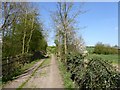
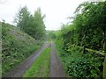
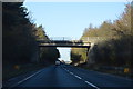
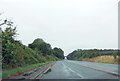

17 photos from this area
Area Information
Key information about the HU17 8RR including its size, population, and administrative classification.
- Area Type
- Postcode
- Area Size
- 41.2 hectares
- Population
- 1458
- Population Density
- 68 people/km²
House Prices in HU17 8RR
10
Properties
£365,000
Average Sold Price
£120,000
Lowest Price
£725,000
Highest Price
Showing 10 properties
| Address | Type | Beds | Baths | Last Sale Price | Last Sale Date | |
|---|---|---|---|---|---|---|
| Broadacres, Beverley Road, Walkington, HU17 8RR | Detached | 4 | 2 | £725,000 | Nov 2025 | |
| Calais, Beverley Road, Walkington, HU17 8RR | house | - | - | £425,000 | Dec 2020 | |
| Valhalla, Beverley Road, Walkington, HU17 8RR | Bungalow | 3 | 2 | £355,000 | Jun 2019 | |
| Humberdale, Beverley Road, Walkington, HU17 8RR | house | - | - | £480,000 | Mar 2019 | |
| Fairview, Beverley Road, Walkington, HU17 8RR | house | - | - | £170,000 | Aug 2015 | |
| Tree Lodge, Beverley Road, Walkington, HU17 8RR | Bungalow | 3 | - | £350,000 | Feb 2010 | |
| Bentley View, 6 Beverley Road, Walkington, HU17 8RR | house | - | - | £120,000 | Jan 2004 | |
| Innisfail, Beverley Road, Walkington, HU17 8RR | Bungalow | - | - | £295,000 | Oct 2003 | |
| The Small House, Beverley Road, Walkington, HU17 8RR | Detached | - | - | - | - | |
| Woodbine, Beverley Road, Walkington, HU17 8RR | Semi-detached | - | - | - | - |
Energy Efficiency in HU17 8RR
Amenities
Schools
| Rank | School | Type | Entry gender | Ages |
|---|
Explore more schools in this area
Go to Schools tabDemographics
Household Size
Two person
most common
Accommodation Type
Houses
most common
Tenure
84
majority
Ethnic Group
White
most common
Religion
N/A
most common
Household Composition
N/A
most common
Age
47
median
Adults (30-64 years)
most common
Household Deprivation
N/A
with no deprivation
NS-SEC
40
in Lower managerial occupations
Explore more demographic insights in this area
Go to Demographics tabPlanning
Planning Constraints
- Flood RiskPremium
- Ramsar Wetland SitesPremium
- Area of Outstanding Natural BeautyPremium
- Protected Nature ReservePremium
- Protected WoodlandPremium