Area Overview for HU17 8PP
Photos of HU17 8PP

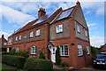
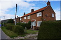


30 photos from this area
Area Information
Key information about the HU17 8PP including its size, population, and administrative classification.
- Area Type
- Postcode
- Area Size
- 2.8 km²
- Population
- 2491
- Population Density
- 42 people/km²
House Prices in HU17 8PP
20
Properties
£465,000
Average Sold Price
£190,000
Lowest Price
£850,000
Highest Price
Showing 20 properties
| Address | Type | Beds | Baths | Last Sale Price | Last Sale Date | |
|---|---|---|---|---|---|---|
| Meadow Cottage, Main Street, Bentley, HU17 8PP | house | - | - | £580,000 | Dec 2020 | |
| Mouse Hill, Beverley Road, Bentley, HU17 8PP | Detached | 4 | 5 | £850,000 | Nov 2020 | |
| St Peters House, Main Street, Bentley, HU17 8PP | Detached | 3 | 3 | £470,000 | Jun 2017 | |
| Keepers Cottage, Main Street, Bentley, HU17 8PP | Semi-detached | - | - | £190,000 | Dec 2004 | |
| Jillywood Farm, Beverley Road, Bentley, HU17 8PP | Detached | 6 | - | £235,000 | Sep 1997 | |
| Bentley Hall, Bentley Lane, Walkington, HU17 8PP | Detached | 6 | 4 | - | - | |
| Tennis 73M From Jillywood Farm 18M From Unnamed Road, Jillywood Farm Access Road, Bentley, HU17 8PP | Leisure | - | - | - | - | |
| Sasso Automotive, Car Showroom, Bentley Hall, Bentley Lane, Walkington, HU17 8PP | shop | - | - | - | - | |
| 2, Manor Farm Cottages, Main Street, Bentley, HU17 8PP | house | - | - | - | - | |
| 4, Manor Farm Cottages, Main Street, Bentley, HU17 8PP | house | - | - | - | - |
Page 1 of 2
Energy Efficiency in HU17 8PP
Amenities
Schools
| Rank | School | Type | Entry gender | Ages |
|---|
Explore more schools in this area
Go to Schools tabDemographics
Household Size
Two person
most common
Accommodation Type
Houses
most common
Tenure
85
majority
Ethnic Group
White
most common
Religion
N/A
most common
Household Composition
N/A
most common
Age
47
median
Adults (30-64 years)
most common
Household Deprivation
N/A
with no deprivation
NS-SEC
46
in Lower managerial occupations
Explore more demographic insights in this area
Go to Demographics tabPlanning
Planning Constraints
- Flood RiskPremium
- Ramsar Wetland SitesPremium
- Area of Outstanding Natural BeautyPremium
- Protected Nature ReservePremium
- Protected WoodlandPremium