Area Overview for HU17 8ED
Photos of HU17 8ED
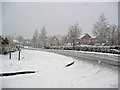
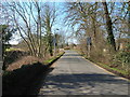
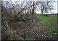
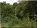

100 photos from this area
Area Information
Key information about the HU17 8ED including its size, population, and administrative classification.
- Area Type
- Postcode
- Area Size
- 2.0 hectares
- Population
- 1933
- Population Density
- 143 people/km²
House Prices in HU17 8ED
36
Properties
£345,830
Average Sold Price
£249,995
Lowest Price
£557,500
Highest Price
Showing 36 properties
| Address | Type | Beds | Baths | Last Sale Price | Last Sale Date | |
|---|---|---|---|---|---|---|
| 9 Westfields Drive, Beverley, HU17 8ED | Detached | 4 | 2 | £370,000 | Dec 2025 | |
| 36 Westfields Drive, Beverley, HU17 8ED | Semi-detached | 3 | 2 | £315,000 | Aug 2025 | |
| 35 Westfields Drive, Beverley, HU17 8ED | Semi-detached | 3 | 1 | £263,000 | Mar 2025 | |
| 34 Westfields Drive, Beverley, HU17 8ED | Detached | 4 | 2 | £405,000 | Oct 2024 | |
| 4 Westfields Drive, Beverley, HU17 8ED | house | - | - | £557,500 | Jul 2024 | |
| 31 Westfields Drive, Beverley, HU17 8ED | Detached | 4 | 2 | £410,000 | Mar 2024 | |
| 12 Westfields Drive, Beverley, HU17 8ED | house | - | - | £350,000 | Mar 2021 | |
| 2 Westfields Drive, Beverley, HU17 8ED | Detached | 3 | 2 | £329,995 | Oct 2020 | |
| 33 Westfields Drive, Beverley, HU17 8ED | Detached | 4 | 2 | £404,995 | Sep 2020 | |
| 19 Westfields Drive, Beverley, HU17 8ED | house | 2 | 1 | £470,000 | Sep 2020 |
Page 1 of 4
Energy Efficiency in HU17 8ED
Amenities
Schools
| Rank | School | Type | Entry gender | Ages |
|---|
Explore more schools in this area
Go to Schools tabDemographics
Household Size
Two person
most common
Accommodation Type
Houses
most common
Tenure
81
majority
Ethnic Group
White
most common
Religion
N/A
most common
Household Composition
N/A
most common
Age
47
median
Adults (30-64 years)
most common
Household Deprivation
N/A
with no deprivation
NS-SEC
36
in Lower managerial occupations
Explore more demographic insights in this area
Go to Demographics tabPlanning
Planning Constraints
- Flood RiskPremium
- Ramsar Wetland SitesPremium
- Area of Outstanding Natural BeautyPremium
- Protected Nature ReservePremium
- Protected WoodlandPremium