Area Overview for HU17 8BW
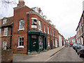
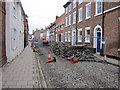
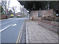
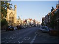
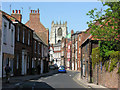
Photos of HU17 8BW


Area Information
Living in HU17 8BW means being part of a small, tightly knit residential cluster in England, home to 1,581 residents. The area is characterised by its compact size and focus on family-oriented living, with a median age of 47 and a majority of residents aged 30–64. This suggests a stable, mature community where many residents may have long-standing ties to the area. The postcode is served by two primary schools, offering families convenient access to education. Locally, residents benefit from nearby retail hubs like Tesco Beverley and Asda Beverley, as well as rail connections to Beverley, Arram, and Cottingham stations, ensuring easy access to larger towns and cities. While the area is small, its proximity to transport links and essential services makes it practical for daily life. The housing stock, dominated by owner-occupied homes, reflects a community that values stability and long-term residency. For buyers, HU17 8BW offers a blend of quiet living and functional connectivity, though its limited size means prospective buyers should consider nearby areas for more options.
- Area Type
- Postcode
- Area Size
- Not available
- Population
- 1581
- Population Density
- 3511 people/km²
The property market in HU17 8BW is dominated by owner-occupied homes, with 56% of residents owning their properties. This contrasts with rental markets where buy-to-let investments are more common, indicating a community prioritising long-term residency over transient housing. The accommodation type is primarily houses, which are typically larger and suited to families or individuals seeking more space. Given the area’s small size, the housing stock is likely limited, meaning buyers may need to look beyond HU17 8BW’s immediate boundaries for additional options. The high proportion of owner-occupiers suggests a stable market with less turnover, which can be appealing to buyers seeking security. However, the limited number of properties also means competition may be fierce, particularly for desirable homes. For those considering the area, the focus on houses rather than flats or apartments may align with preferences for traditional, spacious living.
House Prices in HU17 8BW
No properties found in this postcode.
Energy Efficiency in HU17 8BW
Daily life in HU17 8BW is supported by a range of nearby amenities, including major retail outlets like Tesco Beverley, Asda Beverley, and Heron Beverley. These stores provide easy access to groceries, household goods, and other essentials, reducing the need for long trips. The rail network, with stations at Beverley, Arram, and Cottingham, ensures residents can travel efficiently for work, leisure, or shopping. While the area lacks detailed information on parks or leisure facilities, the presence of retail and transport options suggests a practical, convenience-focused lifestyle. The compact nature of the postcode means amenities are closely clustered, making it easy to access services without excessive travel. For those prioritising ease of access to shops and transport, HU17 8BW offers a functional environment, though it may not cater to those seeking extensive recreational spaces.
Amenities
Schools
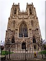
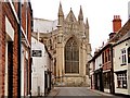
Residents of HU17 8BW have access to two primary schools: Beverley Minster Church of England Voluntary Controlled Primary School and Beverley Minster CE Primary School. Both institutions cater to younger children, providing families with nearby educational options. The presence of two primary schools suggests a focus on early education, though the data does not specify Ofsted ratings or academic performance. For parents, this proximity to schooling reduces commuting time and supports a family-friendly lifestyle. However, the area lacks secondary schools, meaning students may need to travel to nearby towns for further education. The concentration of primary schools indicates a community where families with young children are well-served, but buyers should consider the broader school network when evaluating long-term needs.
| Rank | School | Type | Entry gender | Ages |
|---|
Explore more schools in this area
Go to Schools tabDemographics
The community in HU17 8BW is predominantly composed of adults aged 30–64, with a median age of 47. This indicates a population skewed towards middle-aged individuals, likely reflecting a mix of established families and long-term residents. Home ownership stands at 56%, suggesting a significant portion of the housing stock is occupied by owner-occupiers rather than renters. The accommodation type is primarily houses, which aligns with the area’s residential character and may appeal to those seeking more space. The predominant ethnic group is White, though the data does not provide further breakdowns on diversity or deprivation levels. This demographic profile implies a community with a strong sense of continuity, where many residents may have lived in the area for years. The absence of specific data on deprivation means it is unclear how economic factors might influence quality of life, but the age and ownership figures suggest a relatively stable socioeconomic environment.
Household Size
Accommodation Type
Tenure
Ethnic Group
Religion
Household Composition
Age
Household Deprivation
NS-SEC
Explore more demographic insights in this area
Go to Demographics tabPlanning
Planning Constraints
- Flood RiskPremium
- Ramsar Wetland SitesPremium
- Area of Outstanding Natural BeautyPremium
- Protected Nature ReservePremium
- Protected WoodlandPremium