Area Overview for HU17 7RF
Photos of HU17 7RF
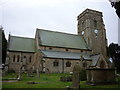
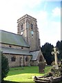
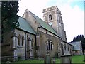
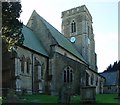

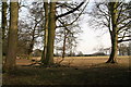
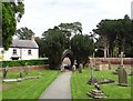

34 photos from this area
Area Information
Key information about the HU17 7RF including its size, population, and administrative classification.
- Area Type
- Postcode
- Area Size
- 52.0 hectares
- Population
- 1447
- Population Density
- 240 people/km²
House Prices in HU17 7RF
72
Properties
£236,024
Average Sold Price
£49,950
Lowest Price
£650,000
Highest Price
Showing 72 properties
| Address | Type | Beds | Baths | Last Sale Price | Last Sale Date | |
|---|---|---|---|---|---|---|
| 7 Main Street, Cherry Burton, HU17 7RF | house | - | - | £142,000 | Oct 2024 | |
| 1D Main Street, Cherry Burton, HU17 7RF | house | - | - | £223,500 | May 2024 | |
| Home Farm Cottage, Main Street, Cherry Burton, HU17 7RF | Bungalow | 2 | 2 | £650,000 | Jul 2023 | |
| 74 Main Street, Cherry Burton, HU17 7RF | house | - | - | £432,460 | Apr 2023 | |
| Wisteria Cottage, 41 Main Street, Cherry Burton, HU17 7RF | Detached | 4 | 2 | £460,000 | Apr 2021 | |
| 76 Main Street, Cherry Burton, HU17 7RF | house | - | - | £290,000 | Sep 2020 | |
| Jasmine Cottage, 78 Main Street, Cherry Burton, HU17 7RF | Detached | 3 | 1 | £310,000 | Aug 2019 | |
| 35 Main Street, Cherry Burton, HU17 7RF | Semi-detached | 3 | 1 | £235,000 | Oct 2018 | |
| 44 Main Street, Cherry Burton, HU17 7RF | Bungalow | - | - | £232,500 | Apr 2018 | |
| 21 Main Street, Cherry Burton, HU17 7RF | Cottage | 2 | 2 | £228,000 | Jan 2018 |
Page 1 of 8
Energy Efficiency in HU17 7RF
Amenities
Schools
| Rank | School | Type | Entry gender | Ages |
|---|
Explore more schools in this area
Go to Schools tabDemographics
Household Size
Two person
most common
Accommodation Type
Houses
most common
Tenure
95
majority
Ethnic Group
White
most common
Religion
N/A
most common
Household Composition
N/A
most common
Age
47
median
Adults (30-64 years)
most common
Household Deprivation
N/A
with no deprivation
NS-SEC
46
in Lower managerial occupations
Explore more demographic insights in this area
Go to Demographics tabPlanning
Planning Constraints
- Flood RiskPremium
- Ramsar Wetland SitesPremium
- Area of Outstanding Natural BeautyPremium
- Protected Nature ReservePremium
- Protected WoodlandPremium