Area Overview for HU17 0TB
Photos of HU17 0TB
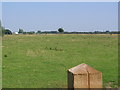
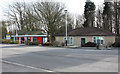
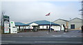
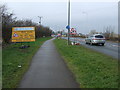

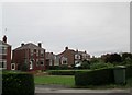
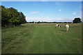
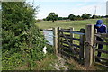
31 photos from this area
Area Information
Key information about the HU17 0TB including its size, population, and administrative classification.
- Area Type
- Postcode
- Area Size
- 1.3 km²
- Population
- 1377
- Population Density
- 542 people/km²
House Prices in HU17 0TB
50
Properties
£196,339
Average Sold Price
£32,500
Lowest Price
£480,000
Highest Price
Showing 50 properties
| Address | Type | Beds | Baths | Last Sale Price | Last Sale Date | |
|---|---|---|---|---|---|---|
| Maplecroft, 17 Hull Road, Woodmansey, HU17 0TB | Bungalow | 3 | 1 | £380,000 | Jun 2025 | |
| 47 Hull Road, Woodmansey, HU17 0TB | house | - | - | £355,000 | Mar 2024 | |
| Hazeldene, 39 Hull Road, Woodmansey, HU17 0TB | Detached | 3 | 1 | £334,000 | Nov 2020 | |
| 49 Hull Road, Woodmansey, HU17 0TB | Detached | 4 | 1 | £480,000 | Oct 2020 | |
| 65 Hull Road, Woodmansey, HU17 0TB | Terraced | 3 | 1 | £172,000 | Mar 2020 | |
| 53 Hull Road, Woodmansey, HU17 0TB | Detached | 3 | 2 | £218,950 | Feb 2017 | |
| Peasholme, 23 Hull Road, Woodmansey, HU17 0TB | Bungalow | 4 | 1 | £235,000 | Nov 2014 | |
| 51 Hull Road, Woodmansey, HU17 0TB | house | - | - | £235,000 | Sep 2014 | |
| 45 Hull Road, Woodmansey, HU17 0TB | house | - | - | £242,000 | Sep 2011 | |
| Nyali, 21 Hull Road, Woodmansey, HU17 0TB | Bungalow | 3 | - | £210,000 | Aug 2011 |
Page 1 of 5
Energy Efficiency in HU17 0TB
Amenities
Schools
| Rank | School | Type | Entry gender | Ages |
|---|
Explore more schools in this area
Go to Schools tabDemographics
Household Size
Two person
most common
Accommodation Type
Houses
most common
Tenure
71
majority
Ethnic Group
White
most common
Religion
N/A
most common
Household Composition
N/A
most common
Age
47
median
Adults (30-64 years)
most common
Household Deprivation
N/A
with no deprivation
NS-SEC
33
in Lower managerial occupations
Explore more demographic insights in this area
Go to Demographics tabPlanning
Planning Constraints
- Flood RiskPremium
- Ramsar Wetland SitesPremium
- Area of Outstanding Natural BeautyPremium
- Protected Nature ReservePremium
- Protected WoodlandPremium