Area Overview for HU17 0LH
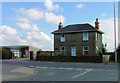
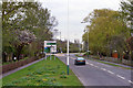
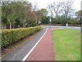
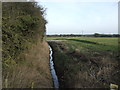
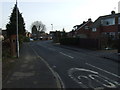
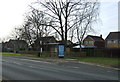
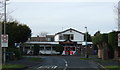
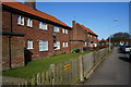
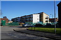
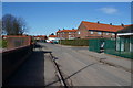
Photos of HU17 0LH


Area Information
Living in HU17 0LH means inhabiting a tightly knit residential cluster in England, where 1,538 people reside across a compact area. With a population density of 1,212 people per square kilometre, this postcode reflects a small, closely connected community. The area’s character is shaped by its proximity to essential services, including retail hubs and rail networks, which cater to daily needs. Residents benefit from a mix of local amenities and nearby towns, making it practical for both independent living and commuting. The presence of primary schools and rail stations within reach underscores its appeal for families and professionals. While the area is small, it offers a balance of convenience and tranquillity, with no major environmental constraints such as protected woodlands or AONB designations. This makes it a straightforward choice for those seeking a manageable, accessible living environment without complex planning restrictions.
- Area Type
- Postcode
- Area Size
- Not available
- Population
- 1538
- Population Density
- 1212 people/km²
The property market in HU17 0LH is defined by a 43% home ownership rate, with houses forming the predominant accommodation type. This suggests a market skewed towards owner-occupied properties rather than rental units, which may influence availability and pricing dynamics. The small area’s housing stock is limited, meaning buyers should consider the immediate surroundings for more options. The presence of houses rather than apartments indicates a preference for traditional, likely family-friendly homes. For those seeking to purchase, the compact nature of the area means proximity to amenities is a key advantage, though the limited size may restrict choices. Potential buyers should also note that the market may cater more to established residents than first-time buyers, given the median age of the population.
House Prices in HU17 0LH
Showing 10 properties
| Address | Type | Beds | Baths | Last Sale Price | Last Sale Date | |
|---|---|---|---|---|---|---|
| 2 Honeyman Close, Beverley, HU17 0LH | Semi-detached | - | - | - | - | |
| 3 Honeyman Close, Beverley, HU17 0LH | Semi-detached | - | - | - | - | |
| 6 Honeyman Close, Beverley, HU17 0LH | Semi-detached | - | - | - | - | |
| 9 Honeyman Close, Beverley, HU17 0LH | Semi-detached | - | - | - | - | |
| 8 Honeyman Close, Beverley, HU17 0LH | Semi-detached | - | - | - | - | |
| 4 Honeyman Close, Beverley, HU17 0LH | Semi-detached | - | - | - | - | |
| 7 Honeyman Close, Beverley, HU17 0LH | Semi-detached | - | - | - | - | |
| 5 Honeyman Close, Beverley, HU17 0LH | Detached | - | - | - | - | |
| 1 Honeyman Close, Beverley, HU17 0LH | Semi-detached | - | - | - | - | |
| 10 Honeyman Close, Beverley, HU17 0LH | Detached | - | - | - | - |
Energy Efficiency in HU17 0LH
The lifestyle in HU17 0LH is supported by nearby retail and transport hubs. Within practical reach are five retail outlets, including Aldi Grovehill, Sainsburys Grovehill, and Spar Waterside, providing everyday shopping convenience. These stores cater to household needs, from groceries to general goods. The area’s rail stations connect residents to broader networks, enabling easy access to cultural, professional, and recreational opportunities beyond the immediate postcode. While parks or leisure facilities are not specified in the data, the proximity to retail and transport suggests a focus on practicality over expansive green spaces. This makes HU17 0LH suitable for those prioritising accessibility and functionality in their daily routines.
Amenities
Schools
Residents of HU17 0LH have access to two primary schools within practical reach. St John of Beverley Roman Catholic Primary School serves the area, while St John of Beverley Catholic Primary School – a Catholic voluntary academy – holds an Ofsted rating of ‘good’. These institutions offer a mix of faith-based and state-funded education, providing families with options aligned with their preferences. The presence of two primary schools suggests a focus on early education, though secondary school options are not detailed in the data. For families prioritising school quality, the ‘good’ rating at one school may be a notable factor. However, the absence of secondary schools in the immediate vicinity could necessitate commuting for older children.
| Rank | School | Type | Entry gender | Ages |
|---|
Explore more schools in this area
Go to Schools tabDemographics
The population of HU17 0LH is predominantly adults aged 30-64, with a median age of 47. This suggests a mature community, likely with established families and professionals. Home ownership sits at 43%, indicating a mix of owner-occupied and rental properties. The accommodation type is primarily houses, reflecting a traditional housing stock rather than apartments or flats. The predominant ethnic group is White, though specific diversity metrics are not provided. The absence of detailed deprivation data means the quality of life cannot be assessed through socioeconomic indicators, but the age profile and housing type imply a stable, middle-aged demographic. This community may prioritise stability over rapid change, with a focus on long-term residency and local connections.
Household Size
Accommodation Type
Tenure
Ethnic Group
Religion
Household Composition
Age
Household Deprivation
NS-SEC
Explore more demographic insights in this area
Go to Demographics tabPlanning
Planning Constraints
- Flood RiskPremium
- Ramsar Wetland SitesPremium
- Area of Outstanding Natural BeautyPremium
- Protected Nature ReservePremium
- Protected WoodlandPremium