Area Overview for HU17 0EA
Photos of HU17 0EA

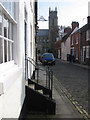
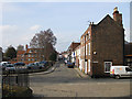
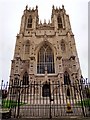

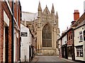
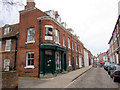
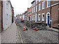
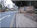
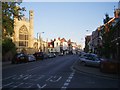
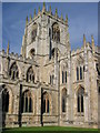
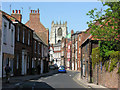
100 photos from this area
Area Information
Key information about the HU17 0EA including its size, population, and administrative classification.
- Area Type
- Postcode
- Area Size
- 5883 m²
- Population
- 1412
- Population Density
- 6540 people/km²
House Prices in HU17 0EA
27
Properties
£145,935
Average Sold Price
£33,000
Lowest Price
£225,000
Highest Price
Showing 27 properties
| Address | Type | Beds | Baths | Last Sale Price | Last Sale Date | |
|---|---|---|---|---|---|---|
| 21 Grovehill Road, Beverley, HU17 0EA | Terraced | 3 | 1 | £216,000 | Jun 2025 | |
| 29 Grovehill Road, Beverley, HU17 0EA | Terraced | 2 | 1 | £190,000 | Dec 2024 | |
| 7 Grovehill Road, Beverley, HU17 0EA | Terraced | 2 | 1 | £225,000 | May 2024 | |
| 13 Grovehill Road, Beverley, HU17 0EA | Terraced | 3 | 1 | £210,000 | May 2024 | |
| 5 Grovehill Road, Beverley, HU17 0EA | Retail | 3 | 1 | £213,000 | Mar 2022 | |
| 45 Grovehill Road, Beverley, HU17 0EA | Terraced | - | - | £177,500 | Jun 2021 | |
| 15 Grovehill Road, Beverley, HU17 0EA | Terraced | 3 | 1 | £210,000 | Dec 2020 | |
| 33 Grovehill Road, Beverley, HU17 0EA | Terraced | 2 | 1 | £169,500 | Mar 2020 | |
| 39 Grovehill Road, Beverley, HU17 0EA | Terraced | 3 | 1 | £160,000 | Apr 2019 | |
| 43 Grovehill Road, Beverley, HU17 0EA | Terraced | 2 | 1 | £174,950 | Feb 2019 |
Page 1 of 3
Energy Efficiency in HU17 0EA
Amenities
Schools
| Rank | School | Type | Entry gender | Ages |
|---|
Explore more schools in this area
Go to Schools tabDemographics
Household Size
One person
most common
Accommodation Type
Houses
most common
Tenure
48
majority
Ethnic Group
White
most common
Religion
N/A
most common
Household Composition
N/A
most common
Age
47
median
Adults (30-64 years)
most common
Household Deprivation
N/A
with no deprivation
NS-SEC
30
in Lower managerial occupations
Explore more demographic insights in this area
Go to Demographics tabPlanning
Planning Constraints
- Flood RiskPremium
- Ramsar Wetland SitesPremium
- Area of Outstanding Natural BeautyPremium
- Protected Nature ReservePremium
- Protected WoodlandPremium