Area Overview for HU16 5NT
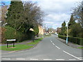
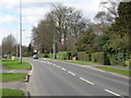
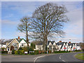
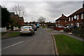
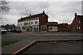
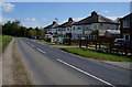
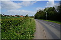
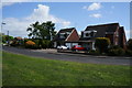
Photos of HU16 5NT


Area Information
Living in HU16 5NT means being part of a tightly knit residential cluster in England, where 1,440 residents occupy a compact area with a population density of 475 people per square kilometre. This postcode area is characterised by a mature demographic, with a median age of 47 and a strong presence of adults aged 30–64. The community is largely owner-occupied, with 80% of homes owned by residents rather than rented. Houses, not flats, dominate the housing stock, reflecting a suburban or semi-rural setting. Daily life here is shaped by proximity to local amenities and a mix of practical infrastructure. While the area lacks large-scale commercial hubs, its small size ensures a quiet, manageable environment. Residents benefit from nearby rail links and a range of retail outlets, making it suitable for those prioritising convenience over urban vibrancy. The low flood risk and absence of protected natural sites suggest a stable, low-constraint living environment, though standard security measures are advisable given the moderate crime risk.
- Area Type
- Postcode
- Area Size
- Not available
- Population
- 1440
- Population Density
- 475 people/km²
The property market in HU16 5NT is dominated by owner-occupied homes, with 80% of properties owned by residents rather than rented out. This suggests a stable market with long-term residents rather than a transient rental-focused area. The accommodation type is predominantly houses, not flats, which is uncommon in more densely populated urban areas. This housing stock likely includes a mix of semi-detached, detached, or terraced homes, typical of smaller towns or villages. The small size of the postcode area means the housing stock is limited, potentially leading to competition among buyers. For those seeking a home here, the focus is on established properties rather than new developments. The high home ownership rate also implies that the area may not be a hotspot for investment or speculative buying, but rather a place where residents have built equity over time. Buyers should consider the local market’s constraints and the potential for limited property turnover.
House Prices in HU16 5NT
No properties found in this postcode.
Energy Efficiency in HU16 5NT
The lifestyle in HU16 5NT is shaped by its proximity to essential retail and transport hubs. Nearby shops include Tesco Cottingham, Co-op Cottingham, and Heron Cottingham, offering a range of everyday goods and services. These stores cater to local needs, reducing the necessity for long trips to larger centres. The rail network, with stations such as Cottingham Railway Station and Hull Railway Station, provides access to broader regional connectivity. While the area lacks large entertainment or leisure facilities, the presence of retail outlets and rail links ensures a functional daily life. The compact size of the postcode means amenities are within practical reach, supporting a self-contained lifestyle. For residents, this balance of convenience and accessibility is a key feature, though those seeking more extensive leisure options may need to travel further.
Amenities
Schools
Residents of HU16 5NT have access to two notable educational institutions. Cottingham High School serves as a primary school, providing early education for local children. Nearby, Cottingham High School and Sixth Form College is an academy with an Ofsted rating of 'good', offering secondary education and sixth-form provision. The combination of a primary school and a secondary academy within the area means families can access a full spectrum of education without long commutes. The presence of a school with a 'good' rating suggests a reliable standard of teaching and facilities, which is a key consideration for parents. While no other schools are listed in the data, the availability of both primary and secondary education in one location reduces the need for additional travel, enhancing the area’s appeal for families.
| Rank | School | Type | Entry gender | Ages |
|---|
Explore more schools in this area
Go to Schools tabDemographics
The population of HU16 5NT is predominantly adults aged 30–64, with a median age of 47, indicating a mature, established community. Home ownership is high, at 80%, suggesting long-term residency and stability. The area is largely composed of houses rather than flats, reflecting a traditional residential layout. The predominant ethnic group is White, though no specific data on diversity or deprivation levels is provided. The age profile suggests a population focused on middle-aged households, possibly with families or retirees. With 475 people per square kilometre, the density is moderate but not overly crowded. This demographic profile implies a community with strong local ties, where residents are likely to have built careers and homes over decades. The lack of specific data on income or deprivation means the quality of life can only be inferred from the available figures, which point to a relatively settled, low-risk environment.
Household Size
Accommodation Type
Tenure
Ethnic Group
Religion
Household Composition
Age
Household Deprivation
NS-SEC
Explore more demographic insights in this area
Go to Demographics tabPlanning
Planning Constraints
- Flood RiskPremium
- Ramsar Wetland SitesPremium
- Area of Outstanding Natural BeautyPremium
- Protected Nature ReservePremium
- Protected WoodlandPremium