Area Overview for HU16 4NE
Photos of HU16 4NE
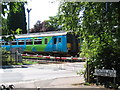
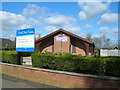
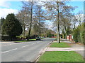
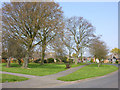
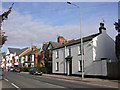
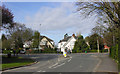
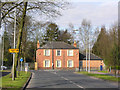
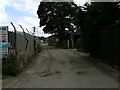
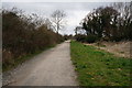
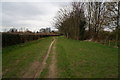
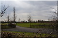
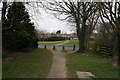
99 photos from this area
Area Information
Key information about the HU16 4NE including its size, population, and administrative classification.
- Area Type
- Postcode
- Area Size
- 1.4 hectares
- Population
- 1316
- Population Density
- 255 people/km²
House Prices in HU16 4NE
34
Properties
£136,543
Average Sold Price
£36,500
Lowest Price
£255,000
Highest Price
Showing 34 properties
| Address | Type | Beds | Baths | Last Sale Price | Last Sale Date | |
|---|---|---|---|---|---|---|
| 64 New Village Road, Cottingham, HU16 4NE | Terraced | 3 | 1 | £180,000 | Sep 2025 | |
| 184 New Village Road, Cottingham, HU16 4NE | Semi-detached | 2 | 1 | £255,000 | Jan 2025 | |
| 170 New Village Road, Cottingham, HU16 4NE | Semi-detached | 3 | 1 | £187,000 | May 2024 | |
| 88 New Village Road, Cottingham, HU16 4NE | Terraced | 3 | 1 | £185,000 | Jan 2022 | |
| 178 New Village Road, Cottingham, HU16 4NE | Bungalow | - | - | £165,000 | Apr 2019 | |
| 176 New Village Road, Cottingham, HU16 4NE | Bungalow | 2 | - | £202,500 | Nov 2018 | |
| 76 New Village Road, Cottingham, HU16 4NE | Detached | 2 | 1 | £175,000 | Nov 2017 | |
| 172 New Village Road, Cottingham, HU16 4NE | house | - | - | £189,000 | May 2017 | |
| 62 New Village Road, Cottingham, HU16 4NE | Terraced | 2 | - | £100,000 | Mar 2012 | |
| 164 New Village Road, Cottingham, HU16 4NE | house | 2 | - | £139,999 | Jul 2011 |
Page 1 of 4
Energy Efficiency in HU16 4NE
Amenities
Schools
| Rank | School | Type | Entry gender | Ages |
|---|
Explore more schools in this area
Go to Schools tabDemographics
Household Size
Two person
most common
Accommodation Type
Houses
most common
Tenure
87
majority
Ethnic Group
White
most common
Religion
N/A
most common
Household Composition
N/A
most common
Age
47
median
Adults (30-64 years)
most common
Household Deprivation
N/A
with no deprivation
NS-SEC
38
in Lower managerial occupations
Explore more demographic insights in this area
Go to Demographics tabPlanning
Planning Constraints
- Flood RiskPremium
- Ramsar Wetland SitesPremium
- Area of Outstanding Natural BeautyPremium
- Protected Nature ReservePremium
- Protected WoodlandPremium