Area Overview for HU15 2PP
Photos of HU15 2PP
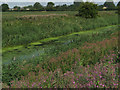
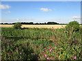
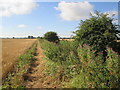
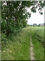
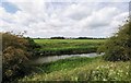
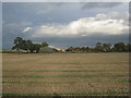
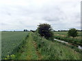

13 photos from this area
Area Information
Key information about the HU15 2PP including its size, population, and administrative classification.
- Area Type
- Postcode
- Area Size
- 88.2 hectares
- Population
- 1962
- Population Density
- 53 people/km²
House Prices in HU15 2PP
10
Properties
£334,000
Average Sold Price
£53,000
Lowest Price
£940,000
Highest Price
Showing 10 properties
| Address | Type | Beds | Baths | Last Sale Price | Last Sale Date | |
|---|---|---|---|---|---|---|
| 68 Main Road, Newport, HU15 2PP | Bungalow | 2 | 1 | £165,000 | Sep 2022 | |
| St Stephens House, 2 Main Road, Newport, HU15 2PP | house | - | - | £940,000 | Aug 2020 | |
| 70 Main Road, Newport, HU15 2PP | Bungalow | 4 | - | £178,000 | Nov 2014 | |
| 66 Main Road, Newport, HU15 2PP | Bungalow | 2 | 1 | £53,000 | Oct 2000 | |
| 72 Main Road, Newport, HU15 2PP | Detached | - | - | - | - | |
| Stoneleigh, 72 Main Road, Newport, HU15 2PP | Bungalow | - | - | - | - | |
| Playing Field, Newport County Primary School, Main Road, Newport, HU15 2PP | Leisure | - | - | - | - | |
| Main Road Recreation Ground, Main Road, Newport, HU15 2PP | Leisure | - | - | - | - | |
| Newport Cemetery, Main Road, Newport, HU15 2PP | commercial | - | - | - | - | |
| New Village Grange, Main Road, Newport, HU15 2PP | Detached | - | - | - | - |
Energy Efficiency in HU15 2PP
Amenities
Schools
| Rank | School | Type | Entry gender | Ages |
|---|
Explore more schools in this area
Go to Schools tabDemographics
Household Size
Two person
most common
Accommodation Type
Houses
most common
Tenure
82
majority
Ethnic Group
White
most common
Religion
N/A
most common
Household Composition
N/A
most common
Age
47
median
Adults (30-64 years)
most common
Household Deprivation
N/A
with no deprivation
NS-SEC
21
in Lower managerial occupations
Explore more demographic insights in this area
Go to Demographics tabPlanning
Planning Constraints
- Flood RiskPremium
- Ramsar Wetland SitesPremium
- Area of Outstanding Natural BeautyPremium
- Protected Nature ReservePremium
- Protected WoodlandPremium