Area Overview for HU15 2JB
Photos of HU15 2JB

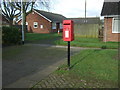
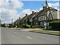
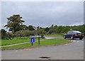
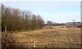
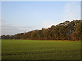
22 photos from this area
Area Information
Key information about the HU15 2JB including its size, population, and administrative classification.
- Area Type
- Postcode
- Area Size
- 1.2 hectares
- Population
- 1083
- Population Density
- 63 people/km²
House Prices in HU15 2JB
26
Properties
£132,932
Average Sold Price
£43,000
Lowest Price
£250,000
Highest Price
Showing 26 properties
| Address | Type | Beds | Baths | Last Sale Price | Last Sale Date | |
|---|---|---|---|---|---|---|
| 17 St Katherines Road, South Cave, HU15 2JB | Bungalow | - | - | £250,000 | Jun 2025 | |
| 15 St Katherines Road, South Cave, HU15 2JB | Bungalow | - | - | £185,000 | Jan 2023 | |
| 2 St Katherines Road, South Cave, HU15 2JB | Bungalow | 2 | 1 | £160,000 | Jul 2022 | |
| 10 St Katherines Road, South Cave, HU15 2JB | Bungalow | - | - | £197,000 | Jun 2022 | |
| 1A St Katherines Road, South Cave, HU15 2JB | Semi-detached | 1 | - | £95,000 | Apr 2022 | |
| 8 St Katherines Road, South Cave, HU15 2JB | Bungalow | - | - | £124,800 | May 2017 | |
| 1B St Katherines Road, South Cave, HU15 2JB | Bungalow | 1 | - | £95,000 | Mar 2014 | |
| 11 St Katherines Road, South Cave, HU15 2JB | Detached | - | - | £157,500 | Jul 2013 | |
| 13 St Katherines Road, South Cave, HU15 2JB | Bungalow | 2 | - | £105,500 | Sep 2011 | |
| 9 St Katherines Road, South Cave, HU15 2JB | Semi-detached | - | - | £43,000 | Dec 1999 |
Page 1 of 3
Energy Efficiency in HU15 2JB
Amenities
Schools
| Rank | School | Type | Entry gender | Ages |
|---|
Explore more schools in this area
Go to Schools tabDemographics
Household Size
Two person
most common
Accommodation Type
Houses
most common
Tenure
75
majority
Ethnic Group
White
most common
Religion
N/A
most common
Household Composition
N/A
most common
Age
47
median
Adults (30-64 years)
most common
Household Deprivation
N/A
with no deprivation
NS-SEC
35
in Lower managerial occupations
Explore more demographic insights in this area
Go to Demographics tabPlanning
Planning Constraints
- Flood RiskPremium
- Ramsar Wetland SitesPremium
- Area of Outstanding Natural BeautyPremium
- Protected Nature ReservePremium
- Protected WoodlandPremium