Area Overview for HU15 2FD
Photos of HU15 2FD
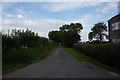
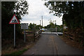
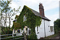
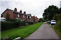
46 photos from this area
Area Information
Key information about the HU15 2FD including its size, population, and administrative classification.
- Area Type
- Postcode
- Area Size
- 3486 m²
- Population
- 1422
- Population Density
- 60 people/km²
House Prices in HU15 2FD
8
Properties
£212,963
Average Sold Price
£158,750
Lowest Price
£265,000
Highest Price
Showing 8 properties
| Address | Type | Beds | Baths | Last Sale Price | Last Sale Date | |
|---|---|---|---|---|---|---|
| 9 Ash Drive, Gilberdyke, HU15 2FD | Detached | 4 | 2 | £255,000 | Dec 2024 | |
| 2 Ash Drive, Gilberdyke, HU15 2FD | Detached | 3 | 2 | £235,000 | Sep 2024 | |
| 5 Ash Drive, Gilberdyke, HU15 2FD | Detached | 3 | 1 | £240,000 | Nov 2022 | |
| 11 Ash Drive, Gilberdyke, HU15 2FD | Detached | 4 | 2 | £265,000 | Apr 2021 | |
| 7 Ash Drive, Gilberdyke, HU15 2FD | house | - | - | £160,000 | Aug 2009 | |
| 1 Ash Drive, Gilberdyke, HU15 2FD | Detached | - | - | £220,000 | Mar 2008 | |
| 3 Ash Drive, Gilberdyke, HU15 2FD | Detached | 5 | 2 | £169,950 | Mar 2004 | |
| 4 Ash Drive, Gilberdyke, HU15 2FD | house | - | - | £158,750 | Nov 2003 |
Energy Efficiency in HU15 2FD
Amenities
Schools
| Rank | School | Type | Entry gender | Ages |
|---|
Explore more schools in this area
Go to Schools tabDemographics
Household Size
Two person
most common
Accommodation Type
Houses
most common
Tenure
83
majority
Ethnic Group
White
most common
Religion
N/A
most common
Household Composition
N/A
most common
Age
47
median
Adults (30-64 years)
most common
Household Deprivation
N/A
with no deprivation
NS-SEC
28
in Lower managerial occupations
Explore more demographic insights in this area
Go to Demographics tabPlanning
Planning Constraints
- Flood RiskPremium
- Ramsar Wetland SitesPremium
- Area of Outstanding Natural BeautyPremium
- Protected Nature ReservePremium
- Protected WoodlandPremium