Area Overview for HU15 1RY
Photos of HU15 1RY
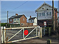
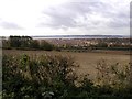
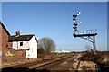
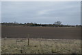
50 photos from this area
Area Information
Key information about the HU15 1RY including its size, population, and administrative classification.
- Area Type
- Postcode
- Area Size
- 1.4 hectares
- Population
- 1516
- Population Density
- 6957 people/km²
House Prices in HU15 1RY
36
Properties
£105,040
Average Sold Price
£63,000
Lowest Price
£150,000
Highest Price
Showing 36 properties
| Address | Type | Beds | Baths | Last Sale Price | Last Sale Date | |
|---|---|---|---|---|---|---|
| 23 Robin Close, Brough, HU15 1RY | house | 2 | 1 | £118,500 | Jun 2025 | |
| 17 Robin Close, Brough, HU15 1RY | Terraced | 2 | 1 | £118,000 | Jun 2024 | |
| 14 Robin Close, Brough, HU15 1RY | house | 2 | 1 | £104,500 | Jan 2024 | |
| 25 Robin Close, Brough, HU15 1RY | Terraced | 2 | 2 | £117,000 | Oct 2022 | |
| 21 Robin Close, Brough, HU15 1RY | house | - | - | £120,000 | Feb 2022 | |
| 11 Robin Close, Brough, HU15 1RY | Flat | - | - | £70,000 | Dec 2021 | |
| 22 Robin Close, Brough, HU15 1RY | house | 2 | 1 | £116,000 | Apr 2021 | |
| 37 Robin Close, Brough, HU15 1RY | Terraced | 2 | 1 | £112,000 | Mar 2021 | |
| 31 Robin Close, Brough, HU15 1RY | Semi-detached | 2 | 2 | £108,500 | Dec 2020 | |
| 36 Robin Close, Brough, HU15 1RY | Terraced | 2 | 1 | £115,000 | Sep 2020 |
Page 1 of 4
Energy Efficiency in HU15 1RY
Amenities
Schools
| Rank | School | Type | Entry gender | Ages |
|---|
Explore more schools in this area
Go to Schools tabDemographics
Household Size
Family (3-5 people)
most common
Accommodation Type
Houses
most common
Tenure
62
majority
Ethnic Group
White
most common
Religion
N/A
most common
Household Composition
N/A
most common
Age
47
median
Adults (30-64 years)
most common
Household Deprivation
N/A
with no deprivation
NS-SEC
45
in Lower managerial occupations
Explore more demographic insights in this area
Go to Demographics tabPlanning
Planning Constraints
- Flood RiskPremium
- Ramsar Wetland SitesPremium
- Area of Outstanding Natural BeautyPremium
- Protected Nature ReservePremium
- Protected WoodlandPremium