Area Overview for HU15 1RQ
Photos of HU15 1RQ
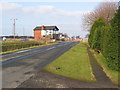
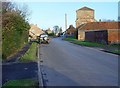
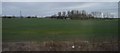
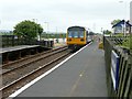
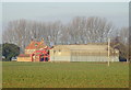
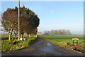
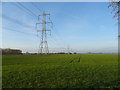
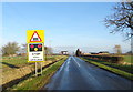
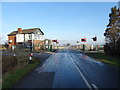

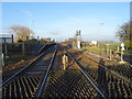
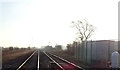
47 photos from this area
Area Information
Key information about the HU15 1RQ including its size, population, and administrative classification.
- Area Type
- Postcode
- Area Size
- 50.2 hectares
- Population
- 1962
- Population Density
- 53 people/km²
House Prices in HU15 1RQ
7
Properties
£89,138
Average Sold Price
£49,750
Lowest Price
£120,000
Highest Price
Showing 7 properties
| Address | Type | Beds | Baths | Last Sale Price | Last Sale Date | |
|---|---|---|---|---|---|---|
| 5, Railway Cottages, Carr Lane, Broomfleet, HU15 1RQ | Semi-detached | - | - | £78,000 | Sep 2021 | |
| Sundown, Carr Lane, Broomfleet, HU15 1RQ | office_workshop | - | - | £108,800 | May 2020 | |
| 6, Railway Cottages, Carr Lane, Broomfleet, HU15 1RQ | Semi-detached | - | - | £49,750 | Jan 2002 | |
| Wisteria Lodge, Carr Lane, Broomfleet, HU15 1RQ | Detached | 3 | 1 | £120,000 | Nov 2001 | |
| Broomfleet Railway Station, Carr Lane, Broomfleet, HU15 1RQ | commercial | - | - | - | - | |
| Northfield House, Carr Lane, Broomfleet, HU15 1RQ | Detached | - | - | - | - | |
| Caravan, Land North Of Level Crossing, Carr Lane, Broomfleet, HU15 1RQ | Mobile Home | - | - | - | - |
Energy Efficiency in HU15 1RQ
Amenities
Schools
| Rank | School | Type | Entry gender | Ages |
|---|
Explore more schools in this area
Go to Schools tabDemographics
Household Size
Two person
most common
Accommodation Type
Houses
most common
Tenure
82
majority
Ethnic Group
White
most common
Religion
N/A
most common
Household Composition
N/A
most common
Age
47
median
Adults (30-64 years)
most common
Household Deprivation
N/A
with no deprivation
NS-SEC
21
in Lower managerial occupations
Explore more demographic insights in this area
Go to Demographics tabPlanning
Planning Constraints
- Flood RiskPremium
- Ramsar Wetland SitesPremium
- Area of Outstanding Natural BeautyPremium
- Protected Nature ReservePremium
- Protected WoodlandPremium