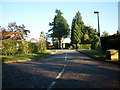
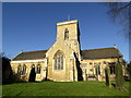
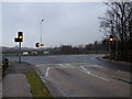
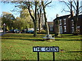
Area Overview for HU15 1LY
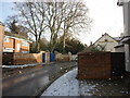
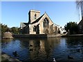
Photos of HU15 1LY


Area Information
Living in HU15 1LY offers a quiet, residential experience in a small cluster of homes spread across 753 square metres. With a population of 2,669 and a density of 222 people per square kilometre, the area feels uncluttered, balancing space with community. The postcode is home to a mature demographic, with a median age of 47 and most residents falling within the 30–64 age range. This suggests a stable, family-oriented environment, with 79% of properties owned by residents rather than rented. Daily life here is defined by proximity to essential services and a low crime risk, making it appealing for those seeking safety and simplicity. The absence of major environmental constraints, such as protected woodlands or AONB areas, means development is not restricted, though the area remains largely residential. For buyers, HU15 1LY represents a blend of practicality and tranquillity, with homes primarily in single-family structures. Its small size means the community is tight-knit, with local amenities and schools within walking or short driving distance.
- Area Type
- Postcode
- Area Size
- 753 m²
- Population
- 2669
- Population Density
- 222 people/km²
The property market in HU15 1LY is characterised by a high rate of home ownership (79%) and a predominance of single-family houses. This suggests a market driven by long-term residents rather than short-term renters, with properties likely to be family homes rather than apartments or flats. The small area size means the housing stock is limited, so buyers may need to consider nearby postcodes for more options. The focus on houses implies a preference for space and privacy, which aligns with the area’s low density and suburban nature. For those seeking to purchase, the high ownership rate indicates a stable market with fewer rental properties, which can be advantageous for buyers looking to avoid landlord management. However, the limited number of homes also means competition may be higher for desirable properties. The absence of commercial or mixed-use developments means the area remains primarily residential, offering a quiet, family-friendly environment.
House Prices in HU15 1LY
Showing 3 properties
| Address | Type | Beds | Baths | Last Sale Price | Last Sale Date | |
|---|---|---|---|---|---|---|
| 1, Ladywell Court, Ladywell Gate, Welton, HU15 1LY | house | - | - | £292,500 | Dec 2021 | |
| 2, Ladywell Court, Ladywell Gate, Welton, HU15 1LY | house | 3 | - | £290,000 | Jan 2021 | |
| 3, Ladywell Court, Ladywell Gate, Welton, HU15 1LY | Terraced | - | - | - | - |
Energy Efficiency in HU15 1LY
The lifestyle in HU15 1LY is supported by a range of nearby amenities, including five retail outlets such as Morrisons Brough, Aldi Bluebird, and Sainsburys Brough. These shops provide everyday essentials, reducing the need for long trips to larger centres. The area is also close to Brough Airport, which may be of interest to those requiring regional travel or frequent flyers. For commuters, five rail stations—Brough, North Ferriby, and Hessle—offer connections to broader transport networks. The presence of these amenities contributes to a convenient, self-contained lifestyle, where residents can access shopping, transport, and travel options without leaving the immediate vicinity. The mix of retail, rail, and aviation facilities ensures practicality for daily life, whether for work, leisure, or family needs.
Amenities
Schools
Residents of HU15 1LY have access to a range of educational institutions, including Welton Primary School, which holds a ‘good’ Ofsted rating, and South Hunsley School and Sixth Form College, an academy with a ‘good’ rating. South Hunsley School, a primary school, does not have an Ofsted rating listed but is likely part of the same educational network. The presence of both primary and secondary education options within the area ensures families can access schooling for children of all ages without long commutes. The mix of school types—primary and academy—provides flexibility, with the academy offering sixth-form provision for older students. This combination is beneficial for families seeking a continuum of education from early years through to post-16 studies. The quality ratings of the schools, particularly the ‘good’ classifications, indicate that educational standards are above average, which is a significant draw for prospective buyers prioritising school quality.
| Rank | School | Type | Entry gender | Ages |
|---|
Explore more schools in this area
Go to Schools tabDemographics
The community in HU15 1LY is predominantly composed of adults aged 30–64, reflecting a mature, stable population. The median age of 47 indicates a demographic skewed towards middle-aged residents, with fewer younger families or retirees compared to other areas. Home ownership is high at 79%, suggesting a strong sense of local investment and long-term residency. The accommodation type is largely houses, which aligns with the area’s low density and suburban feel. The predominant ethnic group is White, though the data does not specify further diversity metrics. With 2,669 residents spread across 753 square metres, the population density of 222 people per square kilometre ensures a balance between space and community interaction. This profile suggests a neighbourhood where neighbours are likely to know one another, with a focus on stability rather than rapid change. The absence of detailed deprivation data means quality of life is inferred from the low crime risk and access to essential services, which are key factors for families and professionals seeking a reliable, low-stress environment.
Household Size
Accommodation Type
Tenure
Ethnic Group
Religion
Household Composition
Age
Household Deprivation
NS-SEC
Explore more demographic insights in this area
Go to Demographics tabPlanning
Planning Constraints
- Flood RiskPremium
- Ramsar Wetland SitesPremium
- Area of Outstanding Natural BeautyPremium
- Protected Nature ReservePremium
- Protected WoodlandPremium