Area Overview for HU15 1HW
Photos of HU15 1HW
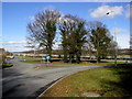
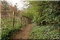
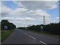
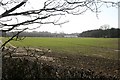

25 photos from this area
Area Information
Key information about the HU15 1HW including its size, population, and administrative classification.
- Area Type
- Postcode
- Area Size
- 32.7 hectares
- Population
- 1212
- Population Density
- 261 people/km²
House Prices in HU15 1HW
48
Properties
£292,027
Average Sold Price
£43,000
Lowest Price
£705,000
Highest Price
Showing 48 properties
| Address | Type | Beds | Baths | Last Sale Price | Last Sale Date | |
|---|---|---|---|---|---|---|
| 23 Stockbridge Road, Elloughton, HU15 1HW | Semi-detached | 2 | 2 | £247,950 | Nov 2024 | |
| 41 Stockbridge Road, Elloughton, HU15 1HW | Detached | 5 | 4 | £395,000 | Mar 2024 | |
| 47 Stockbridge Road, Elloughton, HU15 1HW | Detached | 4 | 2 | £530,000 | Sep 2023 | |
| 45 Stockbridge Road, Elloughton, HU15 1HW | Detached | 4 | 2 | £450,000 | Feb 2023 | |
| 33 Stockbridge Road, Elloughton, HU15 1HW | house | - | - | £540,000 | Aug 2022 | |
| 9 Stockbridge Road, Elloughton, HU15 1HW | Terraced | 2 | 1 | £129,800 | Sep 2021 | |
| 59 Stockbridge Road, Elloughton, HU15 1HW | Bungalow | - | - | £475,000 | Jun 2021 | |
| 43 Stockbridge Road, Elloughton, HU15 1HW | house | - | - | £472,000 | May 2021 | |
| 49 Stockbridge Road, Elloughton, HU15 1HW | Bungalow | - | - | £349,950 | Oct 2018 | |
| 37 Stockbridge Road, Elloughton, HU15 1HW | Detached | 4 | - | £372,500 | Aug 2017 |
Page 1 of 5
Energy Efficiency in HU15 1HW
Amenities
Schools
| Rank | School | Type | Entry gender | Ages |
|---|
Explore more schools in this area
Go to Schools tabDemographics
Household Size
Two person
most common
Accommodation Type
Houses
most common
Tenure
73
majority
Ethnic Group
White
most common
Religion
N/A
most common
Household Composition
N/A
most common
Age
47
median
Adults (30-64 years)
most common
Household Deprivation
N/A
with no deprivation
NS-SEC
35
in Lower managerial occupations
Explore more demographic insights in this area
Go to Demographics tabPlanning
Planning Constraints
- Flood RiskPremium
- Ramsar Wetland SitesPremium
- Area of Outstanding Natural BeautyPremium
- Protected Nature ReservePremium
- Protected WoodlandPremium