Area Overview for HU15 1FS
Photos of HU15 1FS
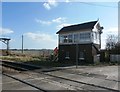
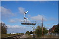
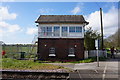
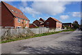
50 photos from this area
Area Information
Key information about the HU15 1FS including its size, population, and administrative classification.
- Area Type
- Postcode
- Area Size
- 1.2 hectares
- Population
- 2669
- Population Density
- 222 people/km²
House Prices in HU15 1FS
80
Properties
£125,095
Average Sold Price
£84,000
Lowest Price
£180,000
Highest Price
Showing 80 properties
| Address | Type | Beds | Baths | Last Sale Price | Last Sale Date | |
|---|---|---|---|---|---|---|
| 22 Liberty Park, Brough, HU15 1FS | Terraced | 2 | 1 | £121,500 | Oct 2025 | |
| 33 Liberty Park, Brough, HU15 1FS | Terraced | 3 | 1 | £180,000 | Sep 2025 | |
| 3 Liberty Park, Brough, HU15 1FS | Semi-detached | 1 | 1 | £125,000 | Sep 2024 | |
| 41 Liberty Park, Brough, HU15 1FS | Terraced | 2 | 1 | £160,000 | Jun 2024 | |
| 34 Liberty Park, Brough, HU15 1FS | Terraced | 2 | 1 | £129,000 | Nov 2023 | |
| 6 Liberty Park, Brough, HU15 1FS | Terraced | 2 | - | £116,000 | Jul 2023 | |
| 25 Liberty Park, Brough, HU15 1FS | house | 2 | - | £122,000 | Jun 2023 | |
| 24 Liberty Park, Brough, HU15 1FS | house | - | - | £124,950 | Aug 2022 | |
| 18 Liberty Park, Brough, HU15 1FS | house | - | - | £127,650 | Dec 2021 | |
| 32 Liberty Park, Brough, HU15 1FS | Terraced | 2 | 1 | £125,000 | Nov 2021 |
Page 1 of 8
Energy Efficiency in HU15 1FS
Amenities
Schools
| Rank | School | Type | Entry gender | Ages |
|---|
Explore more schools in this area
Go to Schools tabDemographics
Household Size
Family (3-5 people)
most common
Accommodation Type
Houses
most common
Tenure
79
majority
Ethnic Group
White
most common
Religion
N/A
most common
Household Composition
N/A
most common
Age
47
median
Adults (30-64 years)
most common
Household Deprivation
N/A
with no deprivation
NS-SEC
48
in Lower managerial occupations
Explore more demographic insights in this area
Go to Demographics tabPlanning
Planning Constraints
- Flood RiskPremium
- Ramsar Wetland SitesPremium
- Area of Outstanding Natural BeautyPremium
- Protected Nature ReservePremium
- Protected WoodlandPremium