Area Overview for HU15 1BJ
Photos of HU15 1BJ
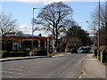
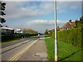
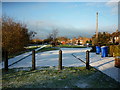
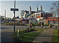
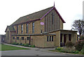
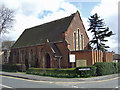
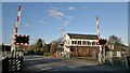
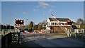
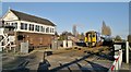
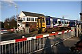
83 photos from this area
Area Information
Key information about the HU15 1BJ including its size, population, and administrative classification.
- Area Type
- Postcode
- Area Size
- 1.9 hectares
- Population
- 1556
- Population Density
- 4855 people/km²
House Prices in HU15 1BJ
20
Properties
£183,093
Average Sold Price
£53,500
Lowest Price
£385,000
Highest Price
Showing 20 properties
| Address | Type | Beds | Baths | Last Sale Price | Last Sale Date | |
|---|---|---|---|---|---|---|
| 77 Welton Road, Brough, HU15 1BJ | Bungalow | 3 | 1 | £193,500 | Jul 2019 | |
| 91 Welton Road, Brough, HU15 1BJ | Bungalow | - | - | £230,000 | Mar 2019 | |
| 97 Welton Road, Brough, HU15 1BJ | Bungalow | 3 | 1 | £165,000 | Mar 2017 | |
| 83 Welton Road, Brough, HU15 1BJ | house | - | - | £220,000 | Jul 2016 | |
| 93 Welton Road, Brough, HU15 1BJ | Bungalow | 2 | 1 | £219,000 | Jul 2015 | |
| 85A Welton Road, Brough, HU15 1BJ | house | - | - | £385,000 | Mar 2015 | |
| 79 Welton Road, Brough, HU15 1BJ | house | 3 | - | £195,000 | Nov 2010 | |
| 81 Welton Road, Brough, HU15 1BJ | house | 2 | - | £145,000 | Sep 2010 | |
| 89 Welton Road, Brough, HU15 1BJ | Detached | - | - | £135,025 | Jul 2002 | |
| 109 Welton Road, Brough, HU15 1BJ | Semi-detached | - | - | £53,500 | Jul 1999 |
Page 1 of 2
Energy Efficiency in HU15 1BJ
Amenities
Schools
| Rank | School | Type | Entry gender | Ages |
|---|
Explore more schools in this area
Go to Schools tabDemographics
Household Size
Two person
most common
Accommodation Type
Houses
most common
Tenure
77
majority
Ethnic Group
White
most common
Religion
N/A
most common
Household Composition
N/A
most common
Age
47
median
Adults (30-64 years)
most common
Household Deprivation
N/A
with no deprivation
NS-SEC
36
in Lower managerial occupations
Explore more demographic insights in this area
Go to Demographics tabPlanning
Planning Constraints
- Flood RiskPremium
- Ramsar Wetland SitesPremium
- Area of Outstanding Natural BeautyPremium
- Protected Nature ReservePremium
- Protected WoodlandPremium