Area Overview for HU14 3PZ
Photos of HU14 3PZ
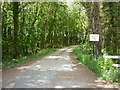
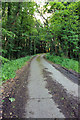
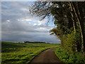
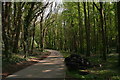
14 photos from this area
Area Information
Key information about the HU14 3PZ including its size, population, and administrative classification.
- Area Type
- Postcode
- Area Size
- 47.7 hectares
- Population
- 1511
- Population Density
- 525 people/km²
House Prices in HU14 3PZ
20
Properties
£333,579
Average Sold Price
£117,950
Lowest Price
£525,000
Highest Price
Showing 20 properties
| Address | Type | Beds | Baths | Last Sale Price | Last Sale Date | |
|---|---|---|---|---|---|---|
| Clocktower Lodge, 12 The Green, Swanland, HU14 3PZ | Detached | 4 | 2 | £525,000 | Mar 2023 | |
| Hedgehog Hovel, 3 The Green, Swanland, HU14 3PZ | house | - | - | £450,000 | Oct 2020 | |
| Makeney House, 8 The Green, Swanland, HU14 3PZ | Detached | 5 | 2 | £525,000 | Sep 2019 | |
| Wolds Croft, 4 The Green, Swanland, HU14 3PZ | Detached | 5 | 2 | £460,000 | Nov 2016 | |
| 5 The Green, Swanland, HU14 3PZ | house | 5 | - | £400,000 | May 2010 | |
| 1 The Green, Swanland, HU14 3PZ | house | - | - | £330,000 | Jan 2010 | |
| 9 The Green, Swanland, HU14 3PZ | Detached | - | - | £385,000 | Jul 2007 | |
| 7 The Green, Swanland, HU14 3PZ | Detached | - | - | £327,500 | Jun 2003 | |
| 11 The Green, Swanland, HU14 3PZ | Detached | - | - | £170,000 | Sep 1999 | |
| 10 The Green, Swanland, HU14 3PZ | Detached | - | - | £155,000 | Jul 1997 |
Page 1 of 2
Energy Efficiency in HU14 3PZ
Amenities
Schools
| Rank | School | Type | Entry gender | Ages |
|---|
Explore more schools in this area
Go to Schools tabDemographics
Household Size
Two person
most common
Accommodation Type
Houses
most common
Tenure
79
majority
Ethnic Group
White
most common
Religion
N/A
most common
Household Composition
N/A
most common
Age
47
median
Adults (30-64 years)
most common
Household Deprivation
N/A
with no deprivation
NS-SEC
47
in Lower managerial occupations
Explore more demographic insights in this area
Go to Demographics tabPlanning
Planning Constraints
- Flood RiskPremium
- Ramsar Wetland SitesPremium
- Area of Outstanding Natural BeautyPremium
- Protected Nature ReservePremium
- Protected WoodlandPremium