Area Overview for HU14 3DY
Photos of HU14 3DY
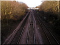

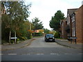
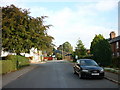
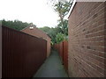
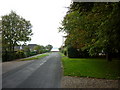
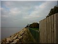
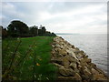


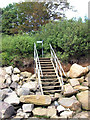
100 photos from this area
Area Information
Key information about the HU14 3DY including its size, population, and administrative classification.
- Area Type
- Postcode
- Area Size
- 1.3 hectares
- Population
- 1450
- Population Density
- 445 people/km²
House Prices in HU14 3DY
29
Properties
£205,326
Average Sold Price
£60,000
Lowest Price
£361,250
Highest Price
Showing 29 properties
| Address | Type | Beds | Baths | Last Sale Price | Last Sale Date | |
|---|---|---|---|---|---|---|
| 23 Riverview Avenue, North Ferriby, HU14 3DY | Semi-detached | 3 | 1 | £332,500 | Sep 2025 | |
| 9 Riverview Avenue, North Ferriby, HU14 3DY | Semi-detached | 3 | 1 | £361,250 | Jan 2023 | |
| 18 Riverview Avenue, North Ferriby, HU14 3DY | house | - | - | £213,000 | Nov 2019 | |
| 15 Riverview Avenue, North Ferriby, HU14 3DY | Semi-detached | 4 | 1 | £250,000 | Feb 2019 | |
| 12 Riverview Avenue, North Ferriby, HU14 3DY | Semi-detached | 3 | 2 | £245,000 | Mar 2018 | |
| 5 Riverview Avenue, North Ferriby, HU14 3DY | Semi-detached | 3 | 1 | £180,000 | Aug 2017 | |
| 17 Riverview Avenue, North Ferriby, HU14 3DY | Semi-detached | 4 | 1 | £240,000 | Apr 2017 | |
| 25 Riverview Avenue, North Ferriby, HU14 3DY | Detached | 3 | 1 | £235,000 | Jul 2015 | |
| 13 Riverview Avenue, North Ferriby, HU14 3DY | Semi-detached | 3 | - | £154,000 | Feb 2014 | |
| 33 Riverview Avenue, North Ferriby, HU14 3DY | house | 3 | - | £207,000 | Sep 2011 |
Page 1 of 3
Energy Efficiency in HU14 3DY
Amenities
Schools
| Rank | School | Type | Entry gender | Ages |
|---|
Explore more schools in this area
Go to Schools tabDemographics
Household Size
Family (3-5 people)
most common
Accommodation Type
Houses
most common
Tenure
85
majority
Ethnic Group
White
most common
Religion
N/A
most common
Household Composition
N/A
most common
Age
47
median
Adults (30-64 years)
most common
Household Deprivation
N/A
with no deprivation
NS-SEC
42
in Lower managerial occupations
Explore more demographic insights in this area
Go to Demographics tabPlanning
Planning Constraints
- Flood RiskPremium
- Ramsar Wetland SitesPremium
- Area of Outstanding Natural BeautyPremium
- Protected Nature ReservePremium
- Protected WoodlandPremium