Area Overview for HU14 3AW
Photos of HU14 3AW
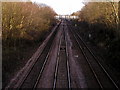

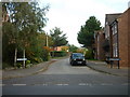
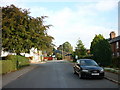
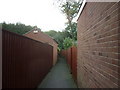


100 photos from this area
Area Information
Key information about the HU14 3AW including its size, population, and administrative classification.
- Area Type
- Postcode
- Area Size
- 2.7 hectares
- Population
- 1450
- Population Density
- 445 people/km²
House Prices in HU14 3AW
34
Properties
£269,376
Average Sold Price
£65,000
Lowest Price
£602,500
Highest Price
Showing 34 properties
| Address | Type | Beds | Baths | Last Sale Price | Last Sale Date | |
|---|---|---|---|---|---|---|
| 17 Nunburnholme Avenue, North Ferriby, HU14 3AW | Semi-detached | 3 | 1 | £318,000 | Mar 2025 | |
| 7 Nunburnholme Avenue, North Ferriby, HU14 3AW | Semi-detached | 5 | 2 | £570,000 | Jul 2024 | |
| 49 Nunburnholme Avenue, North Ferriby, HU14 3AW | Bungalow | 3 | 2 | £410,000 | Jul 2024 | |
| 41 Nunburnholme Avenue, North Ferriby, HU14 3AW | Bungalow | 3 | 2 | £350,000 | Dec 2023 | |
| Springfield, 5 Nunburnholme Avenue, North Ferriby, HU14 3AW | Semi-detached | 4 | 2 | £440,000 | Oct 2023 | |
| 27 Nunburnholme Avenue, North Ferriby, HU14 3AW | Detached | 4 | 3 | £374,000 | Jul 2022 | |
| 55 Nunburnholme Avenue, North Ferriby, HU14 3AW | house | - | - | £274,950 | Jul 2020 | |
| 63 Nunburnholme Avenue, North Ferriby, HU14 3AW | house | - | - | £460,000 | Nov 2017 | |
| 37 Nunburnholme Avenue, North Ferriby, HU14 3AW | Bungalow | 3 | - | £245,000 | Dec 2016 | |
| Shalom, 43 Nunburnholme Avenue, North Ferriby, HU14 3AW | Bungalow | - | - | £218,000 | Oct 2015 |
Page 1 of 4
Energy Efficiency in HU14 3AW
Amenities
Schools
| Rank | School | Type | Entry gender | Ages |
|---|
Explore more schools in this area
Go to Schools tabDemographics
Household Size
Family (3-5 people)
most common
Accommodation Type
Houses
most common
Tenure
85
majority
Ethnic Group
White
most common
Religion
N/A
most common
Household Composition
N/A
most common
Age
47
median
Adults (30-64 years)
most common
Household Deprivation
N/A
with no deprivation
NS-SEC
42
in Lower managerial occupations
Explore more demographic insights in this area
Go to Demographics tabPlanning
Planning Constraints
- Flood RiskPremium
- Ramsar Wetland SitesPremium
- Area of Outstanding Natural BeautyPremium
- Protected Nature ReservePremium
- Protected WoodlandPremium