Area Overview for HU13 9EH
Photos of HU13 9EH
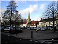
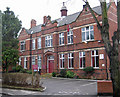
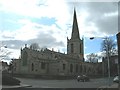
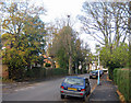
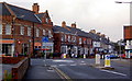
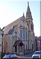
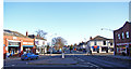
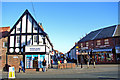
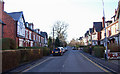
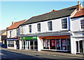
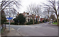
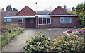
100 photos from this area
Area Information
Key information about the HU13 9EH including its size, population, and administrative classification.
- Area Type
- Postcode
- Area Size
- 1.6 hectares
- Population
- 1527
- Population Density
- 6118 people/km²
House Prices in HU13 9EH
54
Properties
£116,585
Average Sold Price
£30,000
Lowest Price
£200,000
Highest Price
Showing 54 properties
| Address | Type | Beds | Baths | Last Sale Price | Last Sale Date | |
|---|---|---|---|---|---|---|
| 2 Seaton Road, Hessle, HU13 9EH | Terraced | 3 | 1 | £115,000 | May 2025 | |
| 17 Seaton Road, Hessle, HU13 9EH | Terraced | 3 | 1 | £170,000 | Apr 2025 | |
| 4 Seaton Road, Hessle, HU13 9EH | Terraced | 3 | 1 | £129,000 | Apr 2024 | |
| 51 Seaton Road, Hessle, HU13 9EH | Terraced | 3 | 1 | £148,000 | Dec 2023 | |
| 26 Seaton Road, Hessle, HU13 9EH | Terraced | 3 | 2 | £169,950 | Jul 2023 | |
| 13 Seaton Road, Hessle, HU13 9EH | Terraced | 3 | 1 | £200,000 | May 2023 | |
| 44 Seaton Road, Hessle, HU13 9EH | house | 2 | 1 | £133,000 | Nov 2022 | |
| 22 Seaton Road, Hessle, HU13 9EH | house | - | - | £140,000 | Oct 2022 | |
| 55 Seaton Road, Hessle, HU13 9EH | Terraced | 3 | 1 | £180,000 | Sep 2022 | |
| 50 Seaton Road, Hessle, HU13 9EH | Terraced | 3 | 1 | £195,000 | May 2022 |
Page 1 of 6
Energy Efficiency in HU13 9EH
Amenities
Schools
| Rank | School | Type | Entry gender | Ages |
|---|
Explore more schools in this area
Go to Schools tabDemographics
Household Size
Two person
most common
Accommodation Type
Houses
most common
Tenure
69
majority
Ethnic Group
White
most common
Religion
N/A
most common
Household Composition
N/A
most common
Age
47
median
Adults (30-64 years)
most common
Household Deprivation
N/A
with no deprivation
NS-SEC
29
in Lower managerial occupations
Explore more demographic insights in this area
Go to Demographics tabPlanning
Planning Constraints
- Flood RiskPremium
- Ramsar Wetland SitesPremium
- Area of Outstanding Natural BeautyPremium
- Protected Nature ReservePremium
- Protected WoodlandPremium