Area Overview for HU13 9AA
Photos of HU13 9AA
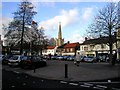
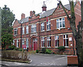
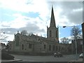
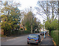
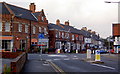
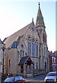
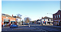
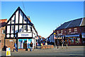
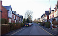
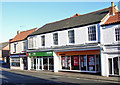
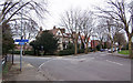
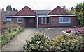
100 photos from this area
Area Information
Key information about the HU13 9AA including its size, population, and administrative classification.
- Area Type
- Postcode
- Area Size
- 5653 m²
- Population
- 1518
- Population Density
- 2795 people/km²
House Prices in HU13 9AA
25
Properties
£153,550
Average Sold Price
£24,000
Lowest Price
£327,500
Highest Price
Showing 25 properties
| Address | Type | Beds | Baths | Last Sale Price | Last Sale Date | |
|---|---|---|---|---|---|---|
| 8 Northgate, Hessle, HU13 9AA | Terraced | 2 | 1 | £101,000 | Aug 2023 | |
| Northgate House, 34 Northgate, Hessle, HU13 9AA | Terraced | 4 | 1 | £154,000 | Aug 2023 | |
| 18 Northgate, Hessle, HU13 9AA | Detached | 3 | 2 | £327,500 | Apr 2023 | |
| 26 Northgate, Hessle, HU13 9AA | Terraced | 2 | 1 | £118,000 | Aug 2022 | |
| 10 Northgate, Hessle, HU13 9AA | Terraced | 2 | 1 | £105,000 | Aug 2019 | |
| Spring Cottage, 24 Northgate, Hessle, HU13 9AA | Terraced | 2 | 1 | £115,000 | Aug 2017 | |
| 40 Northgate, Hessle, HU13 9AA | Bungalow | 2 | 2 | £146,000 | Nov 2014 | |
| 36 Northgate, Hessle, HU13 9AA | house | 3 | - | £325,000 | Mar 2014 | |
| 38 Northgate, Hessle, HU13 9AA | Bungalow | 2 | - | £120,000 | Aug 2011 | |
| 12 Northgate, Hessle, HU13 9AA | house | 2 | 1 | £24,000 | Jun 2001 |
Page 1 of 3
Energy Efficiency in HU13 9AA
Amenities
Schools
| Rank | School | Type | Entry gender | Ages |
|---|
Explore more schools in this area
Go to Schools tabDemographics
Household Size
Two person
most common
Accommodation Type
Houses
most common
Tenure
69
majority
Ethnic Group
White
most common
Religion
N/A
most common
Household Composition
N/A
most common
Age
47
median
Adults (30-64 years)
most common
Household Deprivation
N/A
with no deprivation
NS-SEC
36
in Lower managerial occupations
Explore more demographic insights in this area
Go to Demographics tabPlanning
Planning Constraints
- Flood RiskPremium
- Ramsar Wetland SitesPremium
- Area of Outstanding Natural BeautyPremium
- Protected Nature ReservePremium
- Protected WoodlandPremium