Area Overview for HU13 0QH
Photos of HU13 0QH
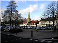
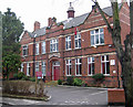
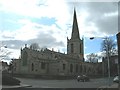
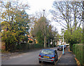
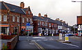
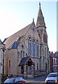
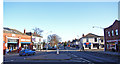
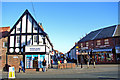
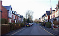
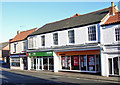
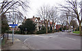
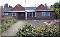
100 photos from this area
Area Information
Key information about the HU13 0QH including its size, population, and administrative classification.
- Area Type
- Postcode
- Area Size
- 4588 m²
- Population
- 1485
- Population Density
- 5348 people/km²
House Prices in HU13 0QH
24
Properties
£78,639
Average Sold Price
£19,000
Lowest Price
£148,500
Highest Price
Showing 24 properties
| Address | Type | Beds | Baths | Last Sale Price | Last Sale Date | |
|---|---|---|---|---|---|---|
| 7 Westbourne Avenue, Hessle, HU13 0QH | Terraced | 2 | 1 | £148,500 | Jun 2023 | |
| 2 Westbourne Avenue, Hessle, HU13 0QH | house | - | - | £143,000 | Sep 2021 | |
| 12 Westbourne Avenue, Hessle, HU13 0QH | Terraced | 2 | 1 | £125,000 | Jun 2021 | |
| 13 Westbourne Avenue, Hessle, HU13 0QH | house | - | - | £129,950 | Aug 2015 | |
| 4 Westbourne Avenue, Hessle, HU13 0QH | house | - | - | £105,000 | Jul 2013 | |
| 6 Westbourne Avenue, Hessle, HU13 0QH | house | - | - | £90,000 | Oct 2011 | |
| 3A Westbourne Avenue, Hessle, HU13 0QH | house | - | - | £80,000 | Aug 2008 | |
| 2A Westbourne Avenue, Hessle, HU13 0QH | Terraced | 2 | 1 | £89,995 | Jan 2006 | |
| 14 Westbourne Avenue, Hessle, HU13 0QH | house | - | - | £34,000 | Apr 1998 | |
| 4A Westbourne Avenue, Hessle, HU13 0QH | house | - | - | £19,000 | Mar 1998 |
Page 1 of 3
Energy Efficiency in HU13 0QH
Amenities
Schools
| Rank | School | Type | Entry gender | Ages |
|---|
Explore more schools in this area
Go to Schools tabDemographics
Household Size
Two person
most common
Accommodation Type
Houses
most common
Tenure
74
majority
Ethnic Group
White
most common
Religion
N/A
most common
Household Composition
N/A
most common
Age
47
median
Adults (30-64 years)
most common
Household Deprivation
N/A
with no deprivation
NS-SEC
37
in Lower managerial occupations
Explore more demographic insights in this area
Go to Demographics tabPlanning
Planning Constraints
- Flood RiskPremium
- Ramsar Wetland SitesPremium
- Area of Outstanding Natural BeautyPremium
- Protected Nature ReservePremium
- Protected WoodlandPremium