Area Overview for HU13 0HW
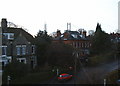
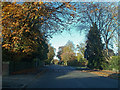
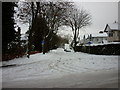
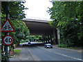
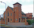
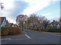
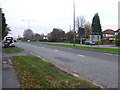
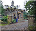
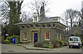
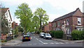
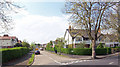
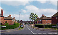
Photos of HU13 0HW
Area Information
Living in HU13 0HW offers a compact, residential experience shaped by its small cluster of homes and proximity to essential services. With a population of 1,966 and a density of 1,016 people per square kilometre, this postcode area is tightly knit, blending suburban comfort with practical accessibility. The median age of 47 suggests a community rooted in stability, with a majority of residents aged 30–64. This demographic profile hints at a mix of established families and professionals, contributing to a mature, low-key atmosphere. Daily life here is defined by proximity to rail links, retail hubs, and schools, ensuring convenience without the sprawl of larger towns. The area’s small size means it is not a commuter hub but a self-contained environment where local amenities and community ties hold significant weight. For buyers, HU13 0HW represents a blend of practicality and quiet living, ideal for those prioritising ease of access to services over sprawling landscapes. Its character lies in its simplicity: a place where homes are predominantly owner-occupied, and the rhythm of life is dictated by nearby schools, shops, and transport options.
- Area Type
- Postcode
- Area Size
- Not available
- Population
- 1966
- Population Density
- 1016 people/km²
The property market in HU13 0HW is dominated by owner-occupied homes, with 84% of properties owned by residents rather than rented. This high ownership rate indicates a community of long-term residents, likely prioritising stability over investment. The accommodation type is predominantly houses, which contrasts with areas where flats or apartments predominate. This suggests a focus on family-friendly, private living, with homes likely offering more space than typical rental properties. Given the area’s small size, the housing stock is limited, making it a niche market for buyers seeking a specific postcode. For those considering the area, the presence of houses may appeal to families or individuals valuing privacy and space. However, the limited number of properties means buyers should explore nearby postcodes for broader options. The market here is not driven by speculative investment but by those seeking a settled, residential environment with strong local connections.
House Prices in HU13 0HW
No properties found in this postcode.
Energy Efficiency in HU13 0HW
The lifestyle in HU13 0HW is defined by accessibility to essential amenities within a short distance. Residents can shop at Heron Hessle, Morrisons Daily, and Sainsburys Hull, offering a range of retail and grocery options. The presence of multiple rail stations, including Hessle and North Ferriby, provides convenient transport links to nearby towns and cities, supporting both daily commutes and weekend travel. Brough Airport, though not a major international hub, offers regional connectivity for those requiring occasional flights. The area’s compact nature means these amenities are within practical reach, reducing the need for long journeys. This proximity to retail, transport, and travel options creates a self-sufficient environment, ideal for those who value convenience without sacrificing the quiet of a residential area. The mix of shops, transport, and travel options ensures daily life remains efficient and flexible.
Amenities
Schools
Residents of HU13 0HW have access to a range of schools, including primary and special education institutions. Hessle High School and Penshurst Primary School, both rated ‘good’ by Ofsted, provide a solid foundation for younger students, while Bridgeview School caters to special educational needs. This mix of school types ensures families have options tailored to different requirements, from mainstream education to specialist support. The presence of a ‘good’-rated primary school is a key advantage, offering parents confidence in the quality of early education. For those prioritising proximity to schools, the area’s compact size means most homes are within walking distance of these institutions. The variety of school types also reflects the community’s diversity in needs, whether for general learning or targeted support. This makes HU13 0HW an attractive choice for families seeking a balanced educational environment.
| Rank | School | Type | Entry gender | Ages |
|---|
Explore more schools in this area
Go to Schools tabDemographics
The community in HU13 0HW is predominantly composed of adults aged 30–64, with a median age of 47. This suggests a mature population, likely including professionals and families with established careers. Home ownership is high, at 84%, indicating a stable, long-term resident base. The area is characterised by houses rather than flats, reflecting a preference for private, family-oriented living. The predominant ethnic group is White, though no specific data on diversity or deprivation is provided. The high home ownership rate and age profile suggest a community with strong local ties and limited turnover. With a population density of 1,016 people per square kilometre, the area is neither sparse nor overcrowded, balancing residential comfort with proximity to amenities. This density, combined with the age distribution, implies a mix of retired individuals, middle-aged professionals, and families, all contributing to a cohesive, low-traffic neighbourhood.
Household Size
Accommodation Type
Tenure
Ethnic Group
Religion
Household Composition
Age
Household Deprivation
NS-SEC
Explore more demographic insights in this area
Go to Demographics tabPlanning
Planning Constraints
- Flood RiskPremium
- Ramsar Wetland SitesPremium
- Area of Outstanding Natural BeautyPremium
- Protected Nature ReservePremium
- Protected WoodlandPremium